Skip to main content
Collections
The Collections
Exhibitions
Favorites
Advanced Search
Home
Collections
More than Meets the Eye: Maps and Prints of Early America
More than Meets the Eye: Maps and Prints of Early America
Close
Refine Results
Artist / Maker / Culture
Thomas Jefferys (ca. 1710-1771)
(3)
Robert Sayer
(1)
Thomas Kitchin
(1)
Andrew Millar (1707-1768)
(1)
Henry Timberlake (1730-1765)
(1)
Thomas Jefferys
(1)
Aaron Arrowsmith
(1)
George Low
(1)
Robert Clerke
(1)
Herman Moll (1654?-1732)
(1)
Load all
Artist / Maker / Culture
Classification(s)
*
Maps
(8)
Exhibitions
More than Meets the Eye: Maps and Prints of Early America
(8)
Promoting America: Maps of the Colonies and the New Republic
(3)
A Rich and Varied Culture
(2)
Date
to
Department
CWF Collection
(8)
Image Available
Origin
*
England, London
(8)
Sort:
Collection (Ascending)
Collection (Descending)
Title (A–Z)
Date (Older First)
Object number (Ascending)
Primary Maker (A-Z)
Last Updated (Ascending)
List
Images
Table
Filters
8 results
Maps
England, London
Clear All Filters
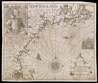
NEW ENGLAND
1624; originally published in 1616
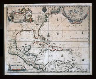
A New Map of the ENGLISH PLANTATIONS in/ AMERICA./ both Continent and Ilands,/ Shewing their true Situation and distance, from/ England or one with another
1673
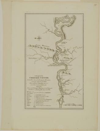
A Draught of the/ CHEROKEE COUNTRY,/ On the West Side of the Twenty four Mountains,/ commonly called Over the Hills
1768 (originally published in 1765)
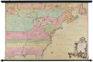
A New MAP of the North Parts of/ AMERICA claimed by FRANCE/ under y.e Names of LOUISIANA, MISSISSIPI, CANADA and/ NEW FRANCE with y.e Adjoyning Territories of ENGLAND and SPAIN.
1720
A MAP of/ the most INHABITED part of/ VIRGINIA/ containing the whole PROVINCE of/ MARYLAND/ with Part of/ PENSILVANIA, NEW JERSEY AND NORTH CAROLINA
1768; first published ca. 1753
A MAP of/ SOUTH CAROLINA/ And a PART of/ GEORGIA./ containing the Whole/ Sea-Coast; all the Islands, Inlets, Rivers, Creeks, Parishes,/ Townships, Boroughs, Roads, and Bridges:/ AS ALSO,/ Several Plantations, with their proper Boundary-Lines...
1757
A MAP of the/ British and French Dominions in/ North America,/ WITH THE/ Roads, Distances, Limits, and Extent of the/SETTLEMENTS,/ Humbly Inscribed to the Right Honourable/ The Earl of Halifax,
February 13, 1755
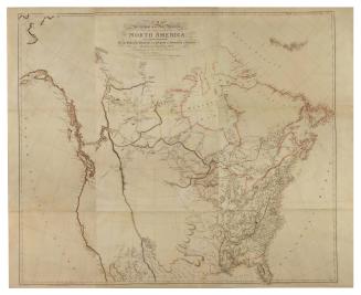
A MAP/ Exhibiting all the New Discoveries/ in the Interior Parts of/ NORTH AMERICA,/ Inscribed by Permission/ To the honourable Governor AND Company OF Adventurers OF England/ TRADING INTO HUDSONS BAY...
1802
Next Page