Skip to main content
Collections
The Collections
Exhibitions
Favorites
Advanced Search
Home
Collections
A Rich and Varied Culture
A Rich and Varied Culture
Close
Refine Results
Artist / Maker / Culture
Joseph T. Scott
(2)
Thomas Jefferys (ca. 1710-1771)
(2)
Robert Sayer
(1)
Henry Timberlake (1730-1765)
(1)
T. F. L.
(1)
Thomas Jefferys
(1)
James Edward Oglethorpe
(1)
Tobias Conrad Lotter
(1)
Samuel John Neele (1758-1824)
(1)
Joshua Fry (ca. 1700-1754) & Peter Jefferson (1708-1757)
(1)
Load all
Artist / Maker / Culture
Classification(s)
*
Maps
(7)
Exhibitions
A Rich and Varied Culture
(7)
More than Meets the Eye: Maps and Prints of Early America
(2)
Promoting America: Maps of the Colonies and the New Republic
(2)
Date
to
Department
*
CWF Collection
(7)
Image Available
Origin
America, Pennsylvania, Philadelphia
(2)
England, London
(2)
Europe, France, Paris
(1)
Europe, Germany, Augsburg
(1)
Europe, Germany, Halle
(1)
Sort:
Collection (Ascending)
Collection (Descending)
Title (A–Z)
Date (Older First)
Object number (Ascending)
Primary Maker (A-Z)
Last Updated (Ascending)
List
Images
Table
Filters
7 results
Maps
CWF Collection
Clear All Filters
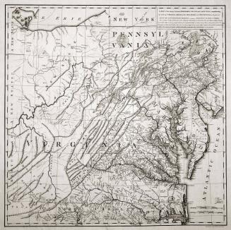
A MAP of/ the most INHABITED part of/ VIRGINIA/ containing the whole PROVINCE of/ MARYLAND/ with Part of/ PENSILVANIA, NEW JERSEY AND NORTH CAROLINA
1768; first published ca. 1753
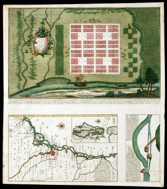
Plan Von Neu Ebenezer
1747
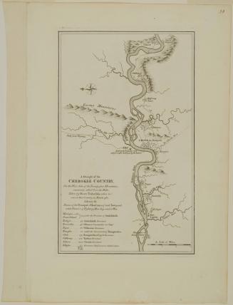
A Draught of the/ CHEROKEE COUNTRY,/ On the West Side of the Twenty four Mountains,/ commonly called Over the Hills
1768 (originally published in 1765)
A MAP of the country between ALBEMARLE SOUND, and LAKE ERIE, comprehending/ the whole of VIRGINIA, MARYLAND, DELAWARE and PENSYLVANIA, with parts of/ several other of the United States of America.
1787
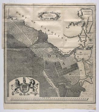
A MAP/ Of the COUNTY of/ SAVANNAH.
1735
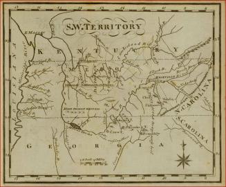
Map of the South West Territories
1795
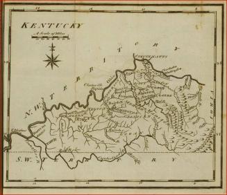
Map of Kentucky
1795
Next Page