Skip to main content
Collections
The Collections
Exhibitions
Favorites
Advanced Search
Home
Collections
Promoting America: Maps of the Colonies and the New Republic
Promoting America: Maps of the Colonies and the New Republic
Close
Refine Results
Artist / Maker / Culture
Theodor De Bry
(2)
John White
(2)
Robert Sayer
(1)
Thomas Hariot
(1)
Thomas Jefferys
(1)
George Low
(1)
Robert Clerke
(1)
Robert Morden (d. 1703)
(1)
Johann Baptist Homann (1663-1724)
(1)
William Berry
(1)
Load all
Artist / Maker / Culture
Classification(s)
Maps
(4)
Prints
(2)
Exhibitions
*
More than Meets the Eye: Maps and Prints of Early America
(6)
Promoting America: Maps of the Colonies and the New Republic
(6)
A Rich and Varied Culture
(1)
Date
to
Department
CWF Collection
(6)
Image Available
Origin
England, London
(3)
Europe, Germany, Frankfurt
(2)
Europe, Germany, Nuremberg
(1)
Sort:
Collection (Ascending)
Collection (Descending)
Title (A–Z)
Date (Older First)
Object number (Ascending)
Primary Maker (A-Z)
Last Updated (Ascending)
List
Images
Table
Filters
6 results
More than Meets the Eye: Maps and Prints of Early America
Clear All Filters
A MAP of/ the most INHABITED part of/ VIRGINIA/ containing the whole PROVINCE of/ MARYLAND/ with Part of/ PENSILVANIA, NEW JERSEY AND NORTH CAROLINA
1768; first published ca. 1753
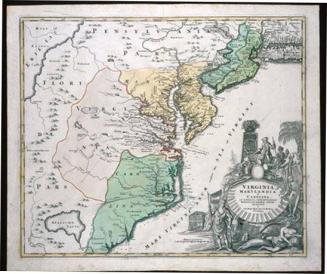
VIRGINIA/ MARYLANDIA/ et/ CAROLINA/ IN AMERICA SEPTENTRIONALI/ Britannorum industria excultæ/ repræsentatæ/ â/ Ioh. Bapt. Homann S.C.M. Geog./ Norimbergæ.
ca. 1714
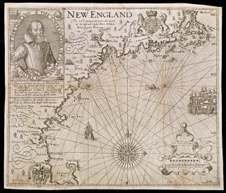
NEW ENGLAND
1624; originally published in 1616
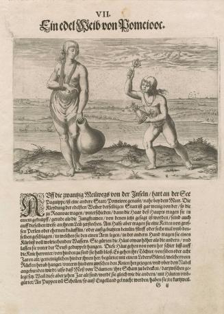
A Noblewoman of Pomeiock
1590
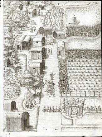
The Town of Secota
1590
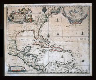
A New Map of the ENGLISH PLANTATIONS in/ AMERICA./ both Continent and Ilands,/ Shewing their true Situation and distance, from/ England or one with another
1673
Next Page