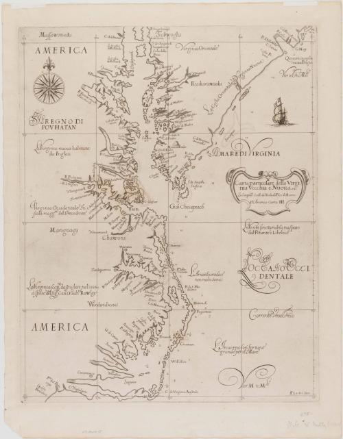
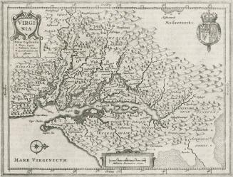
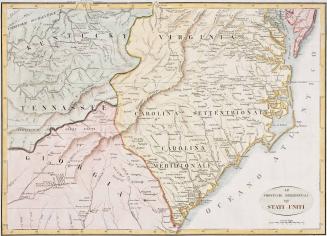
Carta particolare della Virginia Vecchia è Nuoua La longitune Comica da lIsola di Pico di Asores D'America Carta. III.
Date1647
Cartographer
Sir Robert Dudley (1574-1649)
OriginEurope, Italy, Florence
MediumBlack and white line engraving
DimensionsOH: 20 1/8" x OW: 16 1/8"
Credit LineGift of Mr. and Mrs. Richard F. Barry, III, Mr. and Mrs. Macon F. Brock, Mr. and Mrs. David R. Goode, Mr. and Mrs. Conrad M. Hall, Mr. and Mrs. Thomas G. Johnson, Jr., Mr. and Mrs. Charles W. Moorman, IV, and Mr. and Mrs. Richard D. Roberts.
Object number2017-205
DescriptionThe right center cartouche reads: "Carta particolare della Virgi:/ nia Vecchia è Nuoua/ La Longitu:ne Comi:ca da lIsola di Pico di Asores:/ D'America Carta. III."The lower right corner reads: "AF Lucini Fece."
Label TextThe outstanding marine atlas, "Dell'Arcano Del Mare," in which this chart was included, was compiled by an experienced seaman, Sir Robert Dudley. It embodied the most up-to-date naval and navigational knowledge of the time. Although published in Italy, it is considered the first English sea atlas since it was made by an Englishman. It was also the first atlas to use Mercator's Projection, which greatly assists navigation.
Mercator devised the method of drawing the world with the north-south dimension stretched to the east-west dimension at the equator, thus compensating for flattening the shape of the earth on paper.
Since this chart was intended solely as a marine chart, the topography beyond the shoreline has been omitted. Dudley relied on Captain John Smith's map for many of the Indian names and on John White's map for his representation of North Carolina. This is the first edition of the map.
This copy is published in William C. Wooldridge, "Mapping Virginia: From the Age of Exploration to the Civil War" (Charlottesville: University of Virginia Press, 2012), pp. 78-81, #72.
1648
ca. 1775
1760-1780
1793
1733-1763
1590-1600