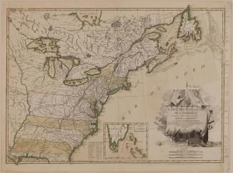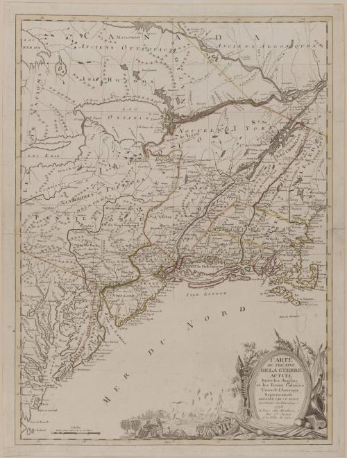
CARTE/ DU THÉATRE/ DE LA GUERRE/ ACTUEL/ Entre les Anglais/ et les Treize Colonies/ Unies de l'Amerique/ Septentrionale/ DRESSÉE PAR J. B. ELIOT/ Ingénieurs des Etats Unis/ 1778.
Date1778
Cartographer
Jean-Baptiste Eliot
Publisher
Louis-Joseph Mondhare
OriginEurope, France, Paris
MediumLine engraving on laid paper with hand color
DimensionsOverall: 28 1/2 × 21 1/2in. (72.4 × 54.6cm)
Framed: 37 7/8 × 30 1/8 × 1 1/8in.
Credit LineMuseum Purchase
Object number1958-633
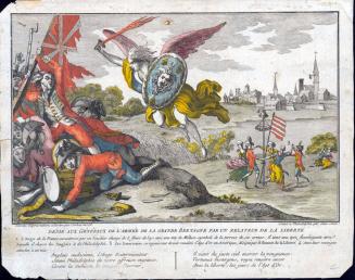
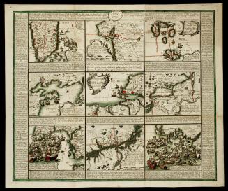
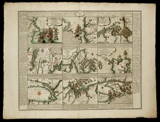
DescriptionThe lower right cartouche reads: "CARTE/ DU THÉATRE/ DE LA GUERRE/ ACTUEL/ Entre les Anglais/ et les Treize Colonies/ Unies de l'Amerique/ Septentrionale/ DRESSÉE PAR J. B. ELIOT/ Ingénieurs des Etats Unis/ 1778./ A Paris chez Mondhare/ Rue S.t Jacques/ A la Ville de Caen"Label TextJ.B. Eliot's map illustrating the Revolutionary War appeared one year after the adjacent map by Louis Brion de la Tour. Although no key is provided for either work, the information supplied in this map surpasses the earlier one. Eliot not only depicted the various encampments, but also indicated the actual lines of march, such as Major John Burgoyne's descent of Lake Champlain and George Washington's activities in Pennsylvania and New Jersey, discussed in the previous label.
J.B. Eliot identified himself on the map as an engineer for the United States. It is possible that he was an aide-de-camp to General Washington, although little is known about his life.
In November 1777, the Continental Congress had adopted the designation of "United States" for the thirteen colonies. This is perhaps the first instance of the term being printed on a map.
1825-1829