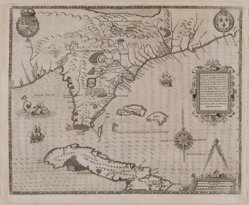
FLORIDAE AMERICAE PROVINCIAE/ Recens & exactissima descriptio/ Auctorè Iacobo le Moÿne cui co-/ gnomen de Morgues, Qui Laud?-/ nierum, Altera Gallorum in eam/ Prouinciam Nauigatione comitat/ est, Atque adhibitis aliquot militibus...
Date1591
Cartographer
Jacques Le Moyne de Morgues (d. 1587)
Publisher
Theodor De Bry
(1528 - 1598)
MediumLine engraving on laid paper
DimensionsOverall: 14 1/2 × 18in. (36.8 × 45.7cm)
Framed: 19 × 22 1/4 × 7/8in.
Credit LineMuseum Purchase
Object number1984-58
DescriptionThe center right cartouche reads: "FLORIDAE AMERICAE PROVINCIAE/ Recens & exactissima descriptio/ Auctorè Iacobo le Moÿne cui co-/ gnomen de Morgues, Qui Laud?-/ nierum, Altera Gallorum in eam/ Prouinciam Nauigatione comitat/ est, Atque adhibitis aliquot militibus,/ Ob pericula, Regionis illius interi-/ora & Maritima diligentissime/ Lustrauit, & Exactissime dimensus/ est, Obseruata etiam singulorum/ Fluminum inter se distantia, ut ipse-/met redux Carolo IX Galliarum/ Regi, demonstrauit."Label TextJacques Le Moyne's map illustrates Cuba northward to North Carolina and was the first to delineate the area in any detail. Such information as the French Huguenot settlements of the 1560s in South Carolina and Florida was included. The latitudes depicted are fairly accurate, however, the shoreline extends too far to the east rather than northeast, causing errors in subsequent maps for the next fifty years.
Jacques Le Moyne came to America in 1564 with a group of French Huguenots who hoped to establish a colony in Florida. A Spanish attack on the colony at Fort Caroline left only a few survivors, who returned to the Continent. Le Moyne was one of those survivors and returned to England with many drawings and a map manuscript. These drawings, and those of John White, were purchased by Theodore de Bry for his multivolume work illustrating the exploration of the New World.
ProvenanceHISTORICAL INFORMATION: This map illustrates Cuba northward to North Carolina and was the first to delineate the area in any detail. The depiction of the coastline is generally correct with respect to latitude, however inaccuracies recording longitude resulted in a coastline that extends too far in an easterly direction. There is a large body of water at the top that may be Le Moyne's respresentation of the Sea of Verrazano and just beneath is a large waterfall that may suggest Native American accounts of Niagara Falls. Unfortunately, errors found on this map were incorporated in other maps for many years to come. Just how this map was compiled raises more questions that the answers provided by the geographic information. Much of the information on the map was gathered during two French Huguenot expeditions to Florida, one in 1562 and another in 1564. Conceived by the French Admiral Gaspard de Coligny, these expeditions were undertaken for the explicit intention of establishing a French foothold in southeastern America, for political, religious and economic reasons. On April 22, 1564, under the leadership of Rene Goulaine de Laudonniere the second of these two expeditions set sail for America, arriving two months later at the site called Fort Caroline, six miles from the mouth of the St. Johns River. It was from this base that the French surveyed and charted the coast and tributaries along northern Florida. Documented in the title engraved on the map, the cartographer was one of the members of this 1564 expedition, Jacques Le Moyne. In his own words, his role in the expedition was "to chart the sea-coast and to observe the situation of the towns and the depth and course of the rivers, and also the harbours, the houses of the people, and anything new there might be in that province." LeMoyne spent fifteen months compiling surveys and recording the customs of the native Americans. Unfortunately, none of the maps and drawings that LeMoyne made while he was in Florida survived. In September 1565, a Spanish force under the command of Pedro Menendez de Aviles captured Fort Caroline and massacred most of the French inhabitants. Laudonniere and LeMoyne were two of the handful of French that managed to escape and return to France. Having been lucky to escape with his life, it is unlikely that he had the time to gather his sketches before leaving. Unlike the previous map, published by Theodor De Bry after John White, there are many inaccuracies in the De Bry/LeMoyne map of Florida. Since Le Moyne left no other cartographic endeavors, we are unable to judge his skill as a geographer. However, we can assume at least some of errors are due to the absence of his field notes and the need to re-draw from memory. To reconstruct the geography on paper, however, Le Moyne would have had several sources at his disposal. In addition to his own personal recollections, there were other survivors from his expedition as well as members from the privious, and subsequent, expeditions who recorded their experiences. Two valuable sources for information could have been the published reports of Rene Goulaine de Laudonniere or Jean Ribault. (Continued in References).
July 1, 1745
July 1, 1745
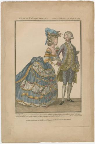
ca. 1770

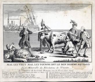
ca. 1750
July 1, 1745
ca. 1755-1758
1750-1760