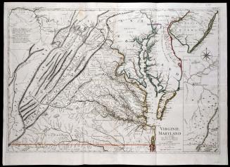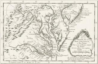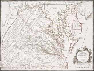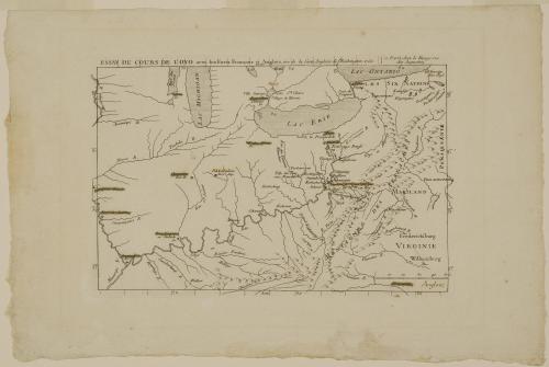
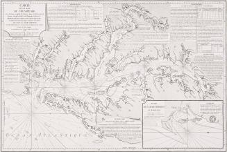
ESSAY DU COURS DE L'OYO avec les Forts François et Anglois, tiré de la Carte Angloise de Washington 1755.
Date1756
After work by
Joshua Fry (ca. 1700-1754) & Peter Jefferson (1708-1757)
Publisher
George Louis Le Rouge (fl. 1740-1780)
OriginEurope, France, Paris
MediumLine engraving on laid paper
DimensionsOverall: 8 × 12 3/8in. (20.3 × 31.4cm)
Framed: 18 1/4 × 22 × 7/8in.
Credit LineMuseum Purchase
Object number1988-420
DescriptionThe upper margin reads: "ESSAY DU COURS DE L'OYO avec les Forts François et Anglois, tiré de la Carte Angloise de Washington 1755./ a Paris chez le Rouge rue/ des Augustins."Label TextThe British Ministry took the position that the Ohio River and surrounding lands were located within the western bounds of the colony of Virginia. In 1753, they ordered the French to vacate the Ohio region altogether. Major George Washington was dispatched to deliver the message. Unsuccessful in forcing the French to retreat, Washington returned to Williamsburg with the French response that they had every right to establish garrisons in the area since the Ohio River was discovered by La Salle and therefore rightfully belonged to France. Washington kept a journal of his western mission, which was published in Williamsburg in 1754. In 1756, George Louis Le Rouge published a French edition of Washington’s work which included this map.
1780-1783
1693