Skip to main content
Collections
The Collections
Exhibitions
Favorites
Advanced Search
Home
Works
Works
Close
Refine Results
Artist / Maker / Culture
*
Robert Morden (d. 1703)
(9)
Richard Blome
(1)
Philip Lea
(1)
Christopher Browne
(1)
John Thornton
(1)
John Thornton
(1)
William Berry
(1)
Phillip Lea (fl. 1666-1700, d. 1700)
(1)
Classification(s)
*
Maps
(9)
Exhibitions
More than Meets the Eye: Maps and Prints of Early America
(1)
Promoting America: Maps of the Colonies and the New Republic
(1)
Date
to
Department
CWF Collection
(9)
Image Available
Origin
England, London
(9)
Sort:
Title (A–Z)
Title (Z–A)
Date (Older First)
Object number (Ascending)
Primary Maker (A-Z)
Last Updated (Ascending)
List
Images
Table
Filters
9 results
Maps
Robert Morden (d. 1703)
Clear All Filters
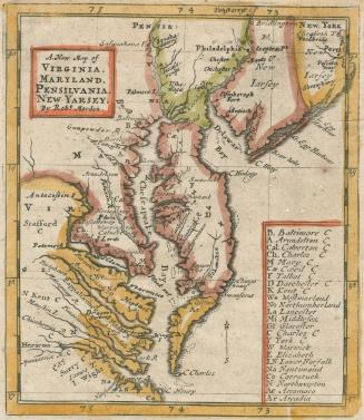
A. New Map of VIRGINIA. MARYLAND. PENSILVANIA. NEW YARSEY
1687
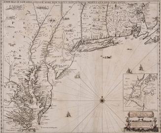
New Map of New England New York New Jarsey Pensilvania Maryland and Virginia
1685
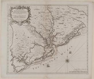
New Map of the Cheif Rivers, Bayes, Creeks,/ Harbours, and Settlements, in/ SOUTH CAROLINA./ Actually Surveyed...
ca. 1695
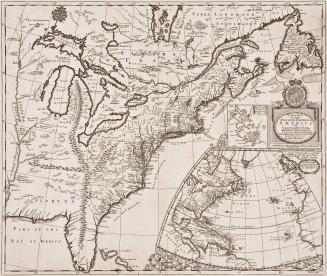
A New Map of the English Empire in America viz Virginia New York Maryland New Jarsey Carolina New England Pennsylvania Newfoundland New France &c by Rob: Morden Sold by Rob't Morden at the Atlas in Cornhill. And by Christopher Brown at ye Globe near the West end of St. Pauls Church: London
1695
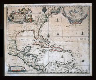
A New Map of the ENGLISH PLANTATIONS in/ AMERICA./ both Continent and Ilands,/ Shewing their true Situation and distance, from/ England or one with another
1673
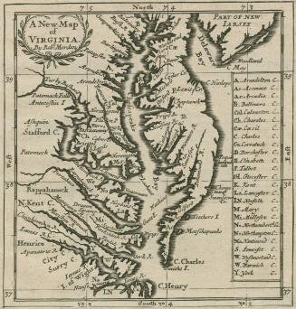
A New Map of VIRGINIA
1688
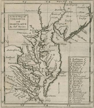
A New Map of Virginia and Maryland By Robt. Morden
1680
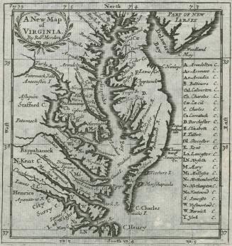
A New Map of Virginia By Robt. Morden
1688/1693/1700
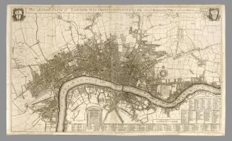
This Actuall Survey of London, Westminster & Southwark is Humbly Dedicated to Ye Ld. Mayor & Court of Alderman
1700
Next Page