Skip to main content
Collections
The Collections
Exhibitions
Favorites
Advanced Search
Home
Works
Works
Close
Refine Results
Artist / Maker / Culture
*
James Turner (1722-1759)
(7)
Lewis Evans (ca. 1700-1756)
(6)
Robert Dodsley
(2)
John D. Davis
(1)
Nicholas Scull (1687-1762)
(1)
James Alexander
(1)
Classification(s)
*
Maps
(7)
Date
to
Department
CWF Collection
(7)
Image Available
Origin
America, Massachusetts, Boston
(3)
America, Pennsylvania, Philadelphia
(3)
England, London
(1)
Sort:
Title (A–Z)
Title (Z–A)
Date (Older First)
Object number (Ascending)
Primary Maker (A-Z)
Last Updated (Ascending)
List
Images
Table
Filters
7 results
Maps
James Turner (1722-1759)
Clear All Filters
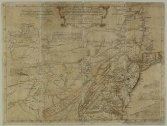
A General Map of the Middle British Colonies
1755
A general MAP of the/ MIDDLE BRITISH COLONIES, in AMERICA;/ Viz VIRGINIA, MÀRILAND, DÈLAWARE, PENSILVANIA,/ NEW-JERSEY, NEW-YORK, CONNECTICUT, and RHODE ISLAND...
1755
A general Map of the/ MIDDLE BRITISH COLONIES, in AMERICA,/. Viz VIRGINIA, MARILAND, DELAWARE, PENSILVANIA,/ NEW JERSEY, NEW YORK, CONNECTICUT, and RHODE ISLAND:
1755
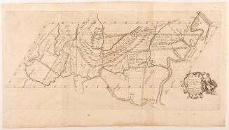
Map No. III (Map of New Jersey)
1747
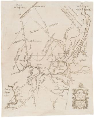
Map No. II (Map of New York and New Jersey)
1747
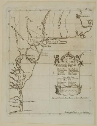
New York, Pennsylvania, Maryland, Virginia, and Carolina (no title)
1747
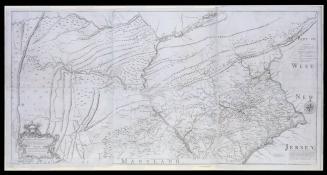
To the Honourable/ Thomas Penn and Richard Penn Esq.rs/ True & absolute Proprietaries & Governours of the Province of/ Pennsylvania & Counties of New-Castle Kent & Sussex on Delaware/ THIS MAP/ Of the improved Part of the Province of/ PENNSYLVANIA.
1759
Next Page