Skip to main content
Collections
The Collections
Exhibitions
Favorites
Advanced Search
Home
Works
Works
Close
Refine Results
Artist / Maker / Culture
P. Stampa
(2)
Thomas Jefferys (ca. 1710-1771)
(2)
Captain John Smith (1580-1631)
(2)
Robert Sayer
(1)
Henry Popple (d. 1743)
(1)
William Faden (1750-1836)
(1)
James Moxon (fl. 1647-1696)
(1)
John Bowles and Son
(1)
Thomas Jefferys
(1)
Richard William Seale
(1)
Load all
Artist / Maker / Culture
Classification(s)
Maps
(9)
Prints
(2)
Exhibitions
*
Promoting America: Maps of the Colonies and the New Republic
(11)
More than Meets the Eye: Maps and Prints of Early America
(3)
A Rich and Varied Culture
(1)
Date
to
Department
CWF Collection
(11)
Image Available
Origin
*
England, London
(11)
Sort:
Title (A–Z)
Title (Z–A)
Date (Older First)
Object number (Ascending)
Primary Maker (A-Z)
Last Updated (Ascending)
List
Images
Table
Filters
11 results
Promoting America: Maps of the Colonies and the New Republic
England, London
Clear All Filters
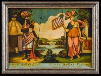
AFRICA-AMERICA
1807
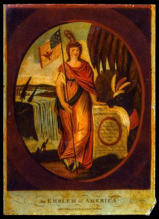
An Emblem of America
1800
A Map of South Carolina and a part of Georgia. Containing the Whole Sea-Coast; all the Islands, Inlets, Rivers, Creeks, Parishes, Townships, Boroughs, Roads and Bridges: As Also, Several Plantations, with their proper Boundary-Lines, and the Names of the Propietors. Composed From Surveys taken by the Hon. William Bull Esq. Lieutenant Governor, Captain Gascoign, Hugh Bryan, Esq.; and William De Brahm Esqr. Surveyor General of the Southn. District of North America, Republished with considerable Additions, from the Surveys made & collected by John Stuart Esqr. His Majesty's Superintendant of Indian Affairs. By William Faden Successor to the late T. Jefferys, Geographer to the King. Charing Cross 1780.
1780
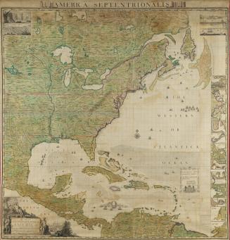
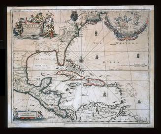
A MAP/ of the BRITISH EMPIRE in/ AMERICA/ with the FRENCH and SPANISH/ SETTLEMENTS adjacent thereto.
1733
A MAP of/ the most INHABITED part of/ VIRGINIA/ containing the whole PROVINCE of/ MARYLAND/ with Part of/ PENSILVANIA, NEW JERSEY AND NORTH CAROLINA
1768; first published ca. 1753
A New and Exact MAP of the DOMINIONS/ of the KING of GREAT BRITAIN/ on y.e Continent of NORTH AMERICA.
After 1735; originally published 1715
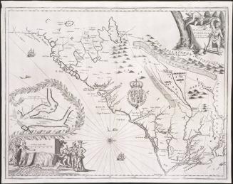
A New/ DISCRIPTION OF/ CAROLINA/ By Order of the/ Lords Proprietors
1672
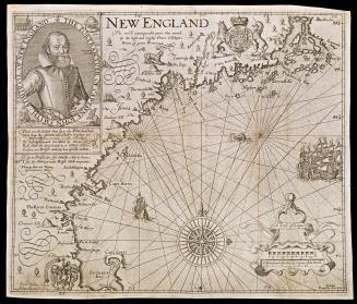
NEW ENGLAND
1624; originally published in 1616
A New Map of the ENGLISH PLANTATIONS in/ AMERICA./ both Continent and Ilands,/ Shewing their true Situation and distance, from/ England or one with another
1673
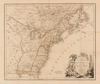
THE/ UNITED STATES/ of/ AMERICA/ laid down/ From the best Authorities,/ Agreeable to the Peace of/ 1783.
1783
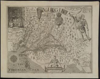
VIRGINIA
1612
Next Page