Skip to main content
Collections
The Collections
Exhibitions
Favorites
Advanced Search
Home
Search Objects
Search
Objects
(12,453)
People
(26,319)
Exhibitions
(56)
Close
Refine Results
Artist / Maker / Culture
Theodor De Bry
(3)
John White
(3)
Thomas Jefferys (ca. 1710-1771)
(3)
James McArdell
(2)
Robert Sayer
(1)
P. Fourdrinier (fl. 1720-1760)
(1)
Sir Joshua Reynolds (1723-1792)
(1)
John Carwitham
(1)
William Byrd II
(1)
Thomas Hariot
(1)
Load all
Artist / Maker / Culture
Classification(s)
Maps
(14)
Prints
(10)
Metals
(1)
Militaria
(1)
Paintings
(1)
Tools & Equipment
(1)
Exhibitions
*
More than Meets the Eye: Maps and Prints of Early America
(28)
A Rich and Varied Culture
(6)
Promoting America: Maps of the Colonies and the New Republic
(6)
"Every Article...suitable for this Country": Furnishing Early Williamsburg [2]
(1)
Date
to
Department
CWF Collection
(28)
Image Available
Origin
England, London
(17)
Europe, Germany, Frankfurt
(3)
America, Massachusetts, Boston
(2)
America, Pennsylvania
(1)
America, Pennsylvania, Philadelphia
(1)
America, Virginia
(1)
Europe, France
(1)
Europe, France, Paris
(1)
Europe, Germany, Nuremberg
(1)
Sort:
Relevance
Title (A–Z)
Date (Older First)
Object number (Ascending)
Primary Maker (A-Z)
Last Updated (Ascending)
List
Images
Table
Filters
28 results for
*
Result type
Objects
People
Exhibitions
More than Meets the Eye: Maps and Prints of Early America
Clear All Filters
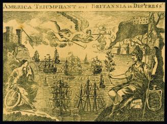
AMERICA TRIUMPHANT and BRITANNIA in DISTRESS
1782
A New MAP of the North Parts of/ AMERICA claimed by FRANCE/ under y.e Names of LOUISIANA, MISSISSIPI, CANADA and/ NEW FRANCE with y.e Adjoyning Territories of ENGLAND and SPAIN.
1720
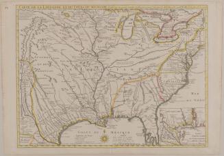
CARTE DE LA LOUISIANE ET DU COURS DU MISSISSIPI Dressée sur un grand nombre de Memoires entrau.tres sur ceux de M.r le Maire Par Guill.aume Delisle de
June 1718
A MAP of/ SOUTH CAROLINA/ And a PART of/ GEORGIA./ containing the Whole/ Sea-Coast; all the Islands, Inlets, Rivers, Creeks, Parishes,/ Townships, Boroughs, Roads, and Bridges:/ AS ALSO,/ Several Plantations, with their proper Boundary-Lines...
1757
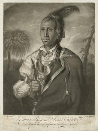
Cunne Shote, the Indian CHIEF, A great Warrior of the Cherokee Nation.
ca. 1763
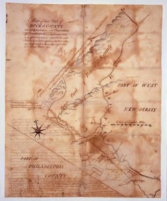
A Map of that Part of/ BUCKS COUNTY/ released by the Indians to the Proprietaries/ of Pensilvania in September 1737 ("Walking Purchase Map")
1737-1738
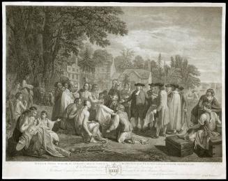
"WILLIAM PENN'S Treaty with the INDIANS, when he founded the PROVINCE of PENSYLVANIA in NORTH AMERICA 1681.
June 12, 1775
Portrait of Isaac Barré (1726-1802)
1766
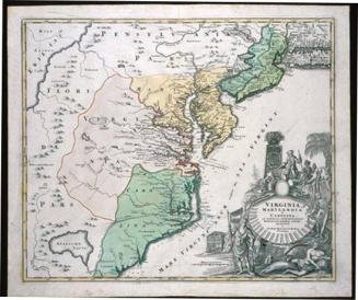
VIRGINIA/ MARYLANDIA/ et/ CAROLINA/ IN AMERICA SEPTENTRIONALI/ Britannorum industria excultæ/ repræsentatæ/ â/ Ioh. Bapt. Homann S.C.M. Geog./ Norimbergæ.
ca. 1714
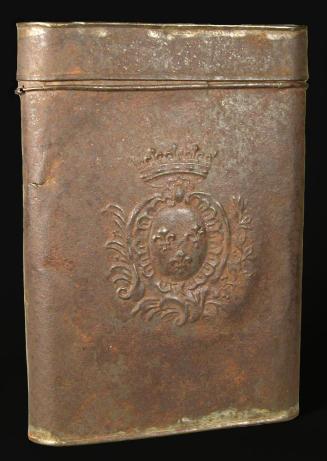
French Military Map Case
ca.1740-1760
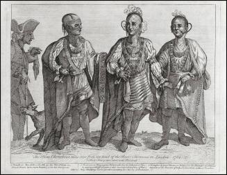
The Three Cherokees, come over from the head of the River Savanna to London, 1762.
ca. 1765
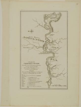
A Draught of the/ CHEROKEE COUNTRY,/ On the West Side of the Twenty four Mountains,/ commonly called Over the Hills
1768 (originally published in 1765)
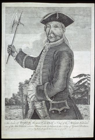
The brave old Hendrick the great SACHEM of Chief of the Mohawk Indians, one of the Six Nations now in Alliance with, & subject to the King of Britain.
ca. 1740
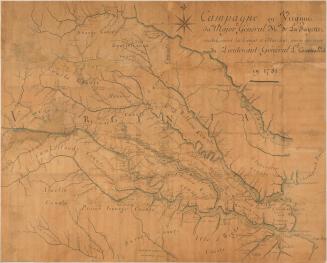
Campagne en Virginie/ du Major Général M.isr de La Fayette,/ ou Se trouvent les Camps et Marches, ainsy que ceux/ du Lieutenant Général L.d Cornwallis./ par le Major Capitaine, aide de Camp du G.l La Fayette./ en 1781.
1781
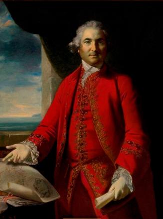
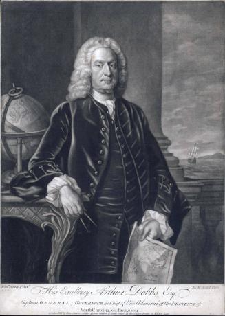
His Excellency Arthur Dobbs Esq.r
1753-1765 (Second state)
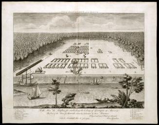
A View of Savannah as it stood the 29th of March 1734
ca. 1734
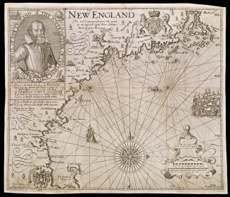
NEW ENGLAND
1624; originally published in 1616
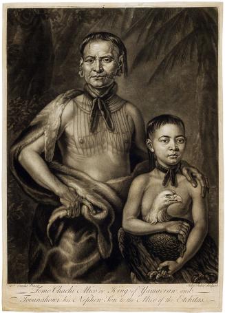
Tomo Chachi Mico of King of Yamacraw, and Tooanahowi his Nephew, Son to the Mico of the Etchitas.
ca. 1734
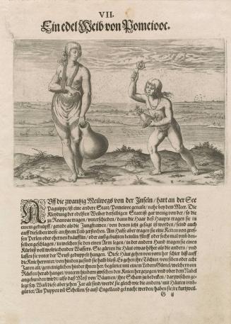
A Noblewoman of Pomeiock
1590
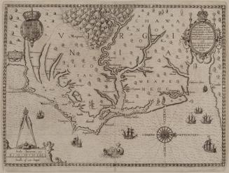
Americæ/ pars, Nunc Virginia/ dicta, primum ab Anglis/ inuenta. sumtibus Dn. Walteri/ Raleigh, Equestris ordinis viri/ Anno Dñi · M D · LXXXV regni vero/ Sereniss: nostræ Reginæ Elizabethæ/ XXVII...
1590
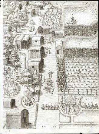
The Town of Secota
1590
A MAP of/ the most INHABITED part of/ VIRGINIA/ containing the whole PROVINCE of/ MARYLAND/ with Part of/ PENSILVANIA, NEW JERSEY AND NORTH CAROLINA
1768; first published ca. 1753
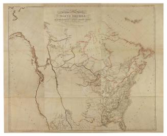
A MAP/ Exhibiting all the New Discoveries/ in the Interior Parts of/ NORTH AMERICA,/ Inscribed by Permission/ To the honourable Governor AND Company OF Adventurers OF England/ TRADING INTO HUDSONS BAY...
1802
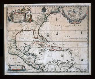
A New Map of the ENGLISH PLANTATIONS in/ AMERICA./ both Continent and Ilands,/ Shewing their true Situation and distance, from/ England or one with another
1673
Next Page