Skip to main content
Collections
The Collections
Exhibitions
Favorites
Advanced Search
Home
Search Objects
Search
Objects
(12,453)
People
(26,319)
Exhibitions
(56)
Close
Refine Results
Artist / Maker / Culture
Theodor De Bry
(3)
John White
(3)
Thomas Hariot
(2)
P. Stampa
(2)
Thomas Jefferys (ca. 1710-1771)
(2)
Captain John Smith (1580-1631)
(2)
Robert Sayer
(1)
Johannes Fredericus Gronovius
(1)
Henry Schenck Tanner (1786-1858)
(1)
Henry Popple (d. 1743)
(1)
Load all
Artist / Maker / Culture
Classification(s)
Maps
(13)
Prints
(5)
Books
(1)
Ceramics
(1)
Exhibitions
*
Promoting America: Maps of the Colonies and the New Republic
(20)
More than Meets the Eye: Maps and Prints of Early America
(6)
A Rich and Varied Culture
(2)
Revolution in Taste
(1)
Date
to
Department
CWF Collection
(20)
Image Available
Origin
England, London
(11)
Europe, Germany, Frankfurt
(3)
America, Pennsylvania, Philadelphia
(1)
England, Derbyshire, Derby
(1)
Europe, France, Paris
(1)
Europe, Germany, Nuremberg
(1)
Europe, Netherlands, Amsterdam
(1)
Europe, Netherlands, Leiden
(1)
Sort:
Relevance
Title (A–Z)
Date (Older First)
Object number (Ascending)
Primary Maker (A-Z)
Last Updated (Ascending)
List
Images
Table
Filters
20 results for
*
Result type
Objects
People
Exhibitions
Promoting America: Maps of the Colonies and the New Republic
Clear All Filters
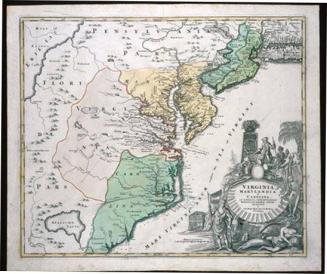
VIRGINIA/ MARYLANDIA/ et/ CAROLINA/ IN AMERICA SEPTENTRIONALI/ Britannorum industria excultæ/ repræsentatæ/ â/ Ioh. Bapt. Homann S.C.M. Geog./ Norimbergæ.
ca. 1714
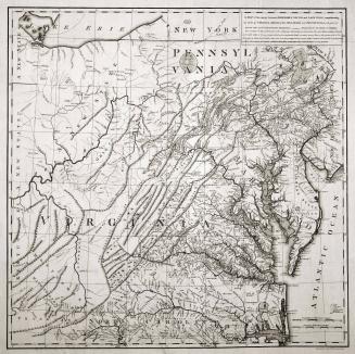
A MAP of the country between ALBEMARLE SOUND, and LAKE ERIE, comprehending/ the whole of VIRGINIA, MARYLAND, DELAWARE and PENSYLVANIA, with parts of/ several other of the United States of America.
1787
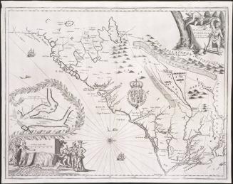
A New/ DISCRIPTION OF/ CAROLINA/ By Order of the/ Lords Proprietors
1672
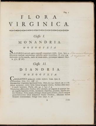
Flora Virginica exhibens Plantas quas Nobilissimus vir. D.D. Johanes Claytonus, Med. Doct. etc. etc. in Virginia crescentes observavit, collegit & obtulit
1762
A Map of South Carolina and a part of Georgia. Containing the Whole Sea-Coast; all the Islands, Inlets, Rivers, Creeks, Parishes, Townships, Boroughs, Roads and Bridges: As Also, Several Plantations, with their proper Boundary-Lines, and the Names of the Propietors. Composed From Surveys taken by the Hon. William Bull Esq. Lieutenant Governor, Captain Gascoign, Hugh Bryan, Esq.; and William De Brahm Esqr. Surveyor General of the Southn. District of North America, Republished with considerable Additions, from the Surveys made & collected by John Stuart Esqr. His Majesty's Superintendant of Indian Affairs. By William Faden Successor to the late T. Jefferys, Geographer to the King. Charing Cross 1780.
1780
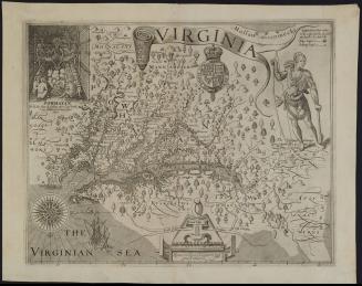
VIRGINIA
1612
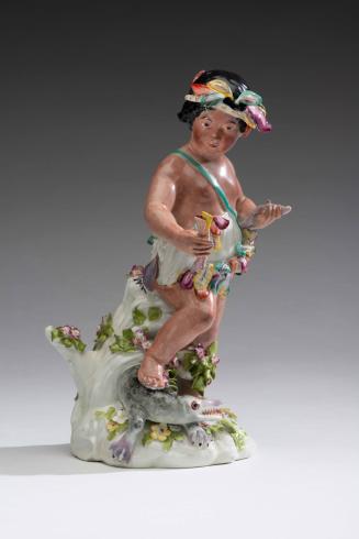
Figure of America
1765-1775
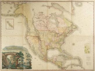
A MAP OF NORTH AMERICA,/ CONSTRUCTED ACCORDING TO THE LATEST INFORMATION:
1822
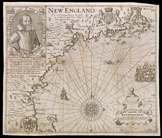
NEW ENGLAND
1624; originally published in 1616
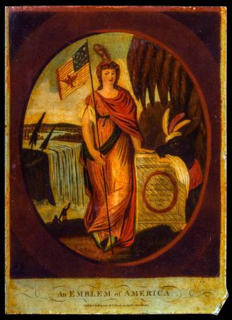
An Emblem of America
1800
Admiranda Narratio fida tamen, de Commodis et Incolarum Ritibus Virginiae (A Briefe and True Report of the New Found Land of Virginia)
1590
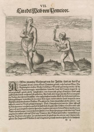
A Noblewoman of Pomeiock
1590
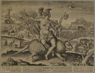
AMERICA
ca. 1650
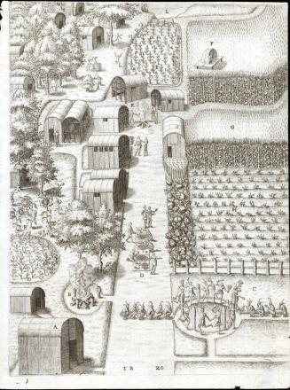
The Town of Secota
1590
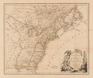
A MAP of/ the most INHABITED part of/ VIRGINIA/ containing the whole PROVINCE of/ MARYLAND/ with Part of/ PENSILVANIA, NEW JERSEY AND NORTH CAROLINA
1768; first published ca. 1753
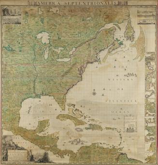
A MAP/ of the BRITISH EMPIRE in/ AMERICA/ with the FRENCH and SPANISH/ SETTLEMENTS adjacent thereto.
1733
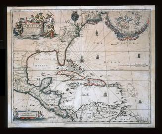
A New Map of the ENGLISH PLANTATIONS in/ AMERICA./ both Continent and Ilands,/ Shewing their true Situation and distance, from/ England or one with another
1673
A New and Exact MAP of the DOMINIONS/ of the KING of GREAT BRITAIN/ on y.e Continent of NORTH AMERICA.
After 1735; originally published 1715
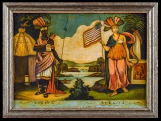
AFRICA-AMERICA
1807
THE/ UNITED STATES/ of/ AMERICA/ laid down/ From the best Authorities,/ Agreeable to the Peace of/ 1783.
1783
Next Page