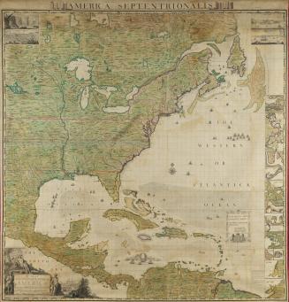
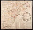
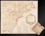
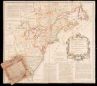

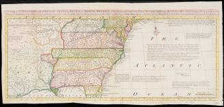
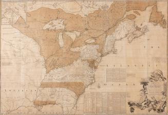
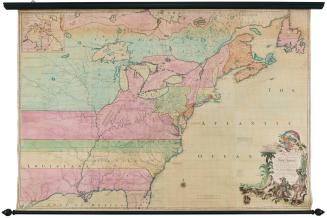
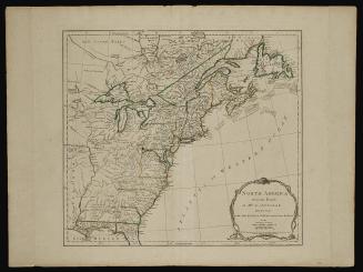
North America from the French of Mr. D' Anville Improved with the Back Settlements of Virginia and Course of Ohio Illustrated with Geographical and Historical Remarks
Date1755
Maker
Thomas Jefferys (ca. 1710-1771)
OriginEngland, London
MediumBlack and white line engraving with period color mounted on linen
DimensionsOverall (When map is unfolded): 18 3/4 × 20 3/4in. (47.6 × 52.7cm)
Other (Dimensions of map case): 5 1/4 × 5in. (5 1/4 × 5in.)
Credit LineGift of Mr. and Mrs. Richard F. Barry, III, Mr. and Mrs. Macon F. Brock, Mr. and Mrs. David R. Goode, Mr. and Mrs. Conrad M. Hall, Mr. and Mrs. Thomas G. Johnson, Jr., Mr. and Mrs. Charles W. Moorman, IV, and Mr. and Mrs. Richard D. Roberts.
Object number2017-222,A
DescriptionTitle in map cartouche: NORTH AMERICA/ From the French of/ M.r D'ANVILLE/ Improved with the Back Settlements of/ Virginia and Course of Ohio/ ILLUSTRATED/ with Geographical and Historical RemarksOn map case:
Front:
A/ POCKET MIRROR/ FOR/NORTH AMERICA/ Which Exhibits at one View/THE/European Settlements/ with the/Claims of the English/ and the/ FRENCH INCROACHMENTS/ Published by Tho.s Jefferys Geographer to His Royal Highness the Prince/ of Wales, the Corner of S.t Martins Lane Charring Cross. /Price 4.s
Verso:
The French Incroachments/ and extensive Claims, as set forth in the late French/ Maps of Mess.rs D’Anville, Robert Bellin, and in/particular the Maps inserted in the Mémoires concer-/ nant Les Limites de L’Acadié are distinguish’d by a faint/ Yellow
Label TextThis map, which was referred to as a “Pocket Mirror” on the label on its case, was designed to be portable and compact. After the map was printed, it was cut into sections (dissected) and adhered to linen to ensure unfolding and refolding with ease. The map, derived from John Mitchell’s large wall map of North America, was published at the start of the French and Indian War or the North American front of the Seven Years War. Given interest in that conflict, the map focuses on boundaries and "French Encroachments" on lands claimed by the British Empire and indicates all of the French forts along the Mississippi and Ohio Valley, and along the Great Lakes.
This copy is published in William C. Wooldridge, "Mapping Virginia: From the Age of Exploration to the Civil War" (Charlottesville: University of Virginia Press, 2012), #121, pp. 127-131.


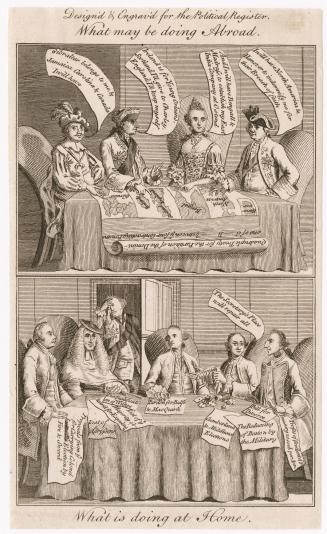
June 10, 1775