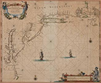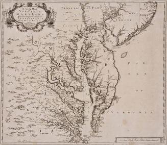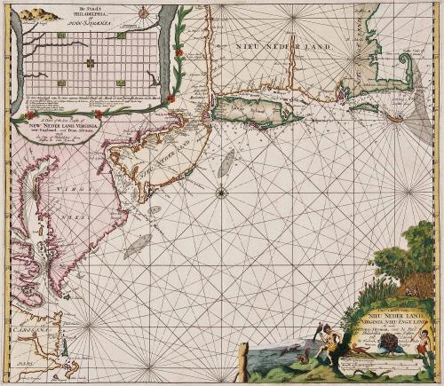
A Chart ofthe Sea Coasts of New Neder Land, Virginia, new-England, and Penn-Silvania. With the Citty of Philadelphia. from Baston to Caho Karrik. [separately] Pas-caert van Nieu Neder Land, Virginia, Nieu Engeland, Als mede Penn-Silvania, met de Stad Philadelfia, van Baston tot C. Carrik. By Hendrick Doneker inde Nieuwen brugsteeg
Date1688
Maker
Hendrik Doncker
(1626 - 1699)
MediumBlack and white line engraving with period color
DimensionsOH: 21" x OW: 24 1/2"
Credit LineMuseum Purchase
Object number2017-77
DescriptionTitle upper left below plan of Philadelphia: "A Chart of the Sea Coasts of/ NEW NEDER LAND. VIRGINIA./ New-England. and Penn-Silvania./ With/ the Ciity of Philadelphia. from/ Baston Cabo Karrik" Cartouche (lower right corner) reads: "Pas-caert van/ NIEU NEDERLAND./ VIRGINIA, NIEU ENGLAND/ Als mode/ Penn-Silvania. met de Stad/ Phialdelphia. van Baston/ tot C. Carrik/ By Henrick Doncker inde/ nieuwenbrugsteeg."
Label TextThis chart was published in "De Nieuwe Groote Vermeerderde Zee Atlas" by Hendrik Doncker. The inset on the upper left corner is one of the earliest plans of newly-founded Philadelphia which was based on a survey Thomas Holme first published in 1683 (London). The key below lists points of interest such as the ships carpentry yard and public grazing lands.
This copy published in William C. Wooldridge, Mapping Virginia: From the Age of Exploration to the Civil War (Charlottesville: University of Virginia Press, 2012), #68, 73-75.