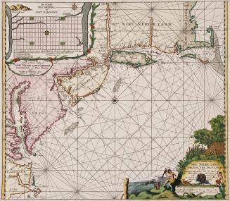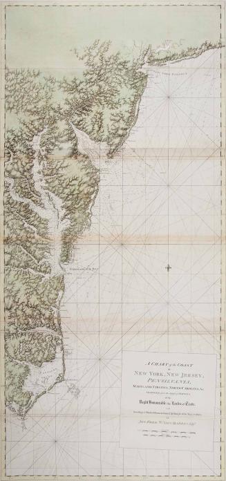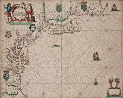
A Chart of the Sea coasts of New-England New Jarsey Virginia Maryland and Carolina From C. Cod to C. Hatteras By John Seller Hydrog'r to the King
Date1675
Maker
John Seller
(fl. 1658-1698)
Maker
James Clark
OriginEngland, London
MediumBlack and white line engraving with period color
DimensionsOH: 17 5/8" x OW: 21 7/8"
Credit LineMuseum Purchase
Object number2017-85
DescriptionCartouche reads: "A Chart/ of the Sea coasts of/ NEW ENGLAND/ NEW-JARSEY VIRGINAI/ MARYLAND and CAROLINA/ From C.Cod to C.Hatteras/ By John Seller Hydrog.r/ to the King"Label TextJohn Seller, hydrographer to the King, recognized the significance of his publication, "Atlas Maritimus" (in which this map first appeared) to English mapmaking.* In the preface he noted that the book was, "...the first essay of this nature that hath been completed in England." The publication of John Seller's chart reflected both a significant shift in imperial dominance and mapmaking between the Dutch to the English.
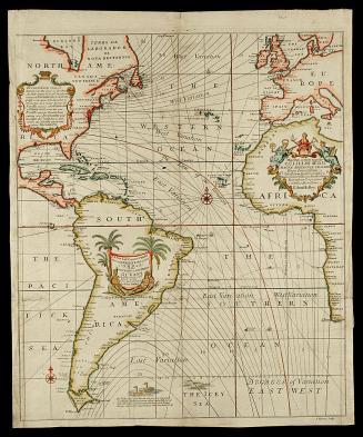
Just as they had dominated trade for most of the century, the Dutch were also the mapmakers to the world for most of the seventeenth-century. The tolerant Dutch Republic became a haven for intellectuals, explorers, artists, merchants, artisans, and mapmakers. Its stronghold on trade meant that the most up-to-date information was collected and compiled in the Netherlands by a competitive and successful map trade. Toward the second half of the seventeenth-century, the Dutch met with steep competition from England on more than one front. The political and social stability ushered in with the Restoration of the Monarchy and the increased strength of the English navy and mercantile enterprises, paved the way for the success of England's mapmakers.
This chart was published immediately after the cession of the New York colony from the Dutch to the English. It recorded the contiguous 1000 miles of coastline now under the control of England. Visually and stylistically Seller followed the conventions of his Dutch counterparts, but he emphasized the Crown's control of the area by adding English place names like "Lower Norfolk" in Virginia. The Seller chart draws on updated and the most current contemporary information from Augustine Herman's map of the Chesapeake region, highlighting the importance of England's oldest colony, Virginia. He also likely referenced Robert Morden and William Berry's," A New Map of the ENGLISH PLANTATIONS in AMERICA" (1673).
*Unlike the standardized atlases published by the Dutch, English mapmakers tended to diversify their modes of publication ranging from separately issued sheets to atlases or made-to-order composite atlases.
This copy is published in William C. Wooldridge, Mapping Virginia: From the Age of Exploration to the Civil War (Charlottesville: University of Virginia Press, 2012), #75, pp. 82-85.