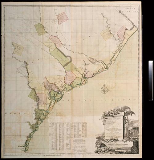
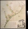
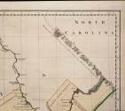
A MAP of/ SOUTH CAROLINA/ And a PART of/ GEORGIA./ containing the Whole/ Sea-Coast; all the Islands, Inlets, Rivers, Creeks, Parishes,/ Townships, Boroughs, Roads, and Bridges:/ AS ALSO,/ Several Plantations, with their proper Boundary-Lines...
Date1757
Cartographer
William Gerard De Brahm (1718-ca. 1799)
Engraver
Thomas Jefferys (ca. 1710-1771)
Publisher
Thomas Jefferys (ca. 1710-1771)
OriginEngland, London
MediumLine engraving on laid paper with hand color
DimensionsOH: 55" x OW 61 3/4" (framed)
Unframed: OH: 53 1/2" x OW: 48 5/8"
Credit LineMuseum Purchase
Object number1973-322
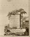
DescriptionThe lower right cartouche reads: "A MAP of/ SOUTH CAROLINA/ And a PART of/ GEORGIA./ containing the Whole/ Sea-Coast; all the Islands, Inlets, Rivers, Creeks, Parishes,/ Townships, Boroughs, Roads, and Bridges:/ AS ALSO,/ Several Plantations, with their proper Boundary-Lines, their/ Names, and the Names of their Proprietors./ Composed/ From Surveys taken by/ The Hon. WILLIAM BULL Esq. Lieutenant Governor,/ Captain GASCOIGN, HUGH BRYAN, Esq;/ And the AUTHOR/ WILLIAM De BRAHM,/ Surveyor General to the Province of South Carolina,/ on of the Surveyors of Georgia,/ And late Captain Engineer under his Imperial Majesty CHARLES VII./ ENGRAV'D BY/ Thomas Jefferys, Geographer to his Royal Highness the/ Prince of Wales."The text below the list of land proprietors reads: "To the Right Honourable/ George Drunk, Earl of Halifax/ FIRST LORD COMMISSIONER/ and to the rest of the Right Honourable the/ LORDS COMMISSIONERS of TRADE & PLANTATIONS./ This Map is most humbly Inscrib'd to their Lordships./ By their Lordships most Obedient/ & most devoted Humble Serv.t/ William de Brahm."
The lower margin reads: "London/ Published According to Act of Parliament by T. Jefferys Oct.r 20 1757."
Label TextThis map of South Carolina and Georgia was created by William Gerard De Brahm in 1757 using scientific topographical surveys, depicting geography that was vastly superior to any previous map of the area. De Brahm immigrated to Georgia from Germany in 1751 and was appointed Surveyor General of the Southern District in 1764. He accurately illustrated the positions and courses of the rivers and their tributaries, located the many islands off the coast more correctly, and identified the parish settlements and boundaries on the South Carolina and Georgia coasts. The map was updated and republished in 1780 (see 2019-49 A&B).
The decorative cartouche reflects South Carolina’s profitable trade in indigo. Designed by an unidentified maker, the scene illustrates slaves processing the indigo into dye cubes and packing them for shipment.