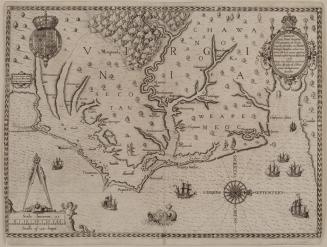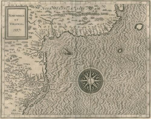
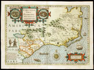
NORUMBEGA/ ET/ VIRGINIA./ 1597.
Date1597
Cartographer
Cornelis van Wyfliet
OriginEurope, Belgium, Louvain
MediumBlack and white line engraving on laid paper
DimensionsOH: 11 3/8" x OW: 14 1/8"
Credit LineMuseum Purchase
Object number2017-25
DescriptionCartouche in upper left corner reads: "NORUMBEGA/ ET/ VIRGINIA/ 1597."Label TextThis map depicts Virginia and North Carolina, and appeared in Cornelis Wyfliet's "Descriptionis Ptolemaicae Augmentum." The Virginia and North Carolina portions of this map were taken directly from John White (1984-46). This map was published in the first printed atlas relating exclusively to America.
This copy published in William C. Wooldridge, "Mapping Virginia: From the Age of Exploration to the Civil War" (Charlottesville: University of Virginia Press, 2012), pp. 17-20, #10.
First published 1606; This example: 1634

1723-1728, originally published ca. 1701