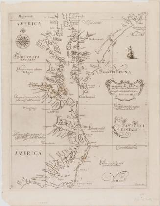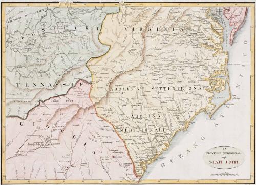
Le Province Meridionali degli Stati Uniti
Date1827
Maker
Giuseppe Pezze
(fl. 1814)
OriginEurope, Italy, Milan
MediumBlack and white line engraving with hand color
DimensionsOH: 18" x OW: 22 1/4"
Credit LineMuseum Purchase
Object number2017-169
DescriptionLower right cartouche reads: "LE / PROVINCIE MERIDIONALI / degli / STATI UNITI"Upper margin center reads: "Longitudine del Meridiano di Parigi"
Lower right margin reads: "Guis. Pezze inc."
Label TextThis map was engraved by Guiseppe Pezze and originally published in Carlo Botta's "Storia Della Guerra Dell'IndependenzaDegli Stati Uniti D'America" (Milan, Italy: Antonio Fontana, 1827). This map is one of a style of maps associated with La Fouchefoucauld-Lancourt's "Voyage dans les États-Unis d'Amérique" and other publications on American in the early-nineteenth century published in Europe and Great Britain.
This copy is published in William C. Wooldridge, Mapping Virginia: From the Age of Exploration to the Civil War (Charlottesville: University of Virginia Press, 2012), pp. 198, #183
For more information on this style of map see: North Carolina Map Blog, "Another La Rouchefoucauld-Liancourt Map," December 3, 2013 (http://blog.ncmaps.org/index.php/la-rochefoucauld-liancourt-maps-of-carolinas/)
1760-1780