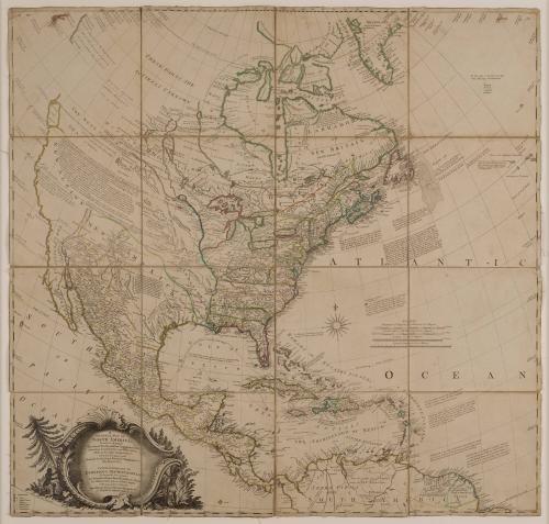
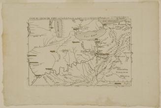
A General Map of North America
Date1762
Publisher
Mary Ann Rocque
Cartographer
John Rocque
OriginEngland, London
MediumLine engraving with hand color on laid paper, dissected and mounted on textile
DimensionsOverall: 39 × 37in. (99.1 × 94cm)
Credit LineMuseum Purchase, The Joseph H. and June S. Hennage Fund
Object number2024-4
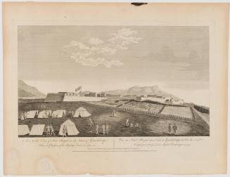
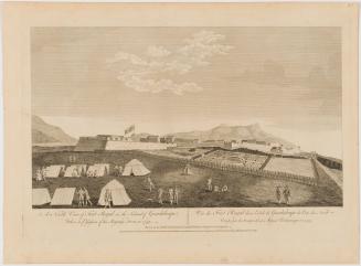
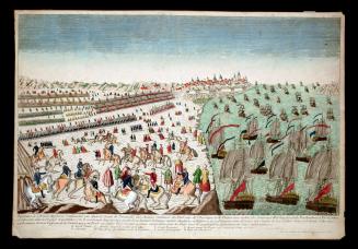
DescriptionCartouche reads: "A/ GENERAL MAP OF/ NORTH AMERICA;/ In which is Express'd / The several New Roads, Forts, Engagements, & c./ taken from Actual Surveys and Observations/ Made in the Army employ'd there,/ From the Year 1754, to 1761;/ Drawn by the late JOHN ROCQUE, Topographer to/ His MAJESTY. / CARTES GENERALES DE/ L'AMERIQUE SEPTENTRIONALE;/ En les quelles sont exprimis/ Les Nouvelles Routes, Forts, Batailles, &c. d'apres/ les OBservations qui ou ete faites depouis l'An 1754, jusqu'a L'An 1761: / Recuellies par feu JEAN ROCQUE, Topogaphe de/ Sa MAJESTE BRITANNIQUE, &c."Label TextMary Rocque (widow of mapmaker Jean Rocque who took over his business after his death) published this map in 1762 as the French and Indian War was coming to a close. It would have been a useful tool, especially dissected and mounted on linen, for any party engaged in that global conflict. The cartography represents the most up-to-date information available at the time – information gleaned from Lewis Evans’ and John Mitchell’s maps of British North America. The map is also dissected and mounted on linen, allowing us to discuss the materiality of maps and different ways they were used. There are also two fabric loops at the top of the map that appear to be period hanging hardware.
ProvenanceBefore 2024, [Daniel Crouch Rare Books, London]; 2024-present, purchased by The Colonial Williamsburg Foundation (Williamsburg, VA).
ca. 1725


after 1788