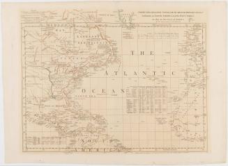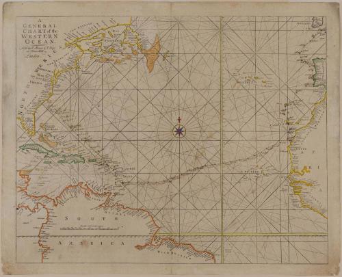
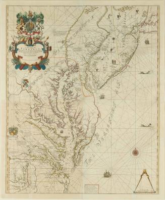
A/ GENERAL/ CHART of the/ WESTERN/ OCEAN.
Date1743-1765 (originally published 1721)
Cartographer
John Seller
(fl. 1658-1698)
Publisher
William Mount
Publisher
Thomas Page
OriginEngland, London
MediumLine engraving on laid paper with modern outline color
DimensionsOverall: 18 7/8 × 23 3/4in. (47.9 × 60.3cm)
Framed: 31 1/8 × 26 7/8 × 7/8in.
Credit LineMuseum Purchase
Object number1989-199
DescriptionThe text in the upper left reads: "A/ GENERAL/ CHART of the/ WESTERN/ OCEAN./ Sold by W. Mount & T. Page/ on Tower Hill/ London."Label TextThis map was copied directly from an earlier chart made by John Seller around 1675 and included in The English Pilot, an atlas used for navigation. Of interest on this map are the manuscript notations, which tracked a voyage that took place in 1765. The ports of call indicate that the ship was transporting trade goods from southern Europe to North Carolina. The manuscript notations also indicate the time it took this ship to make its voyage. When sailing in a direct route, a typical transatlantic crossing from east to west lasted six to eight weeks. In this instance, the layovers to acquire cargo extended the journey by about three months.

1723-1728, originally published ca. 1701