Skip to main content
Collections
The Collections
Exhibitions
Favorites
Advanced Search
Home
Works
Works
Close
Refine Results
Artist / Maker / Culture
William Faden (1750-1836)
(12)
Herman Moll (1654?-1732)
(10)
Thomas Jefferys (ca. 1710-1771)
(10)
Robert Sayer (1725-1794) & John Bennett (fl. 1760-1787)
(10)
Robert Morden (d. 1703)
(9)
Emanuel Bowen
(6)
Robert Sayer (1725-1794)
(6)
Thomas Bowles II
(5)
Captain John Smith (1580-1631)
(5)
John Seller
(4)
Load all
Artist / Maker / Culture
Classification(s)
*
Maps
(122)
Sewing Accessories
(1)
Exhibitions
Promoting America: Maps of the Colonies and the New Republic
(9)
More than Meets the Eye: Maps and Prints of Early America
(8)
A Rich and Varied Culture
(2)
Date
to
Department
CWF Collection
(122)
Image Available
Origin
*
England, London
(122)
Sort:
Title (A–Z)
Title (Z–A)
Date (Older First)
Object number (Ascending)
Primary Maker (A-Z)
Last Updated (Ascending)
List
Images
Table
Filters
122 results
Maps
England, London
Clear All Filters
AN ACCURATE MAP/ OF/ NORTH AND SOUTH CAROLINA/ WITH THEIR INDIAN FRONTIERS,/ Shewing in a distinct manner all the/ MOUNTAINS, RIVERS, SWAMPS, MARSHES, BAYS, CREEKS,/ HARBOURS, SANDBANKS and SOUNDINGS on the COASTS;/ with/ the ROADS and INDIAN PATHS;
May 30, 1775
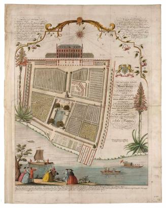
AN ACCURATE SURVEY of the Botanic Gardens AT CHELSEA...
March 31, 1751
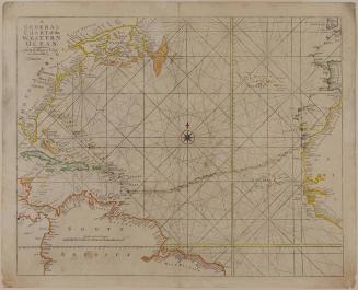
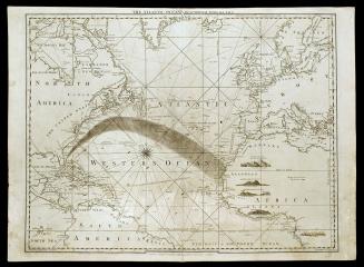
A/ GENERAL/ CHART of the/ WESTERN/ OCEAN.
1743-1765 (originally published 1721)
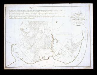
A/ Map/ of/ General Washington's Farm,/ of/ MOUNT VERNON/ from/ A Drawing transmitted by the General.
1801
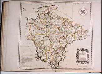
A/ MAP/ OF THE/ COUNTY of DEVON,/ WITH THE/ CITY and COUNTY/ OF/ EXETER,/ Delineated from an ACTUAL SURVEY, on Twelve Sheets of/ Imperial Paper, the Scale an Inch to a Mile.
1765
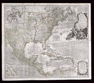
AN/ Accurate/ MAP/ OF/ NORTH AMERICA./ Describing and distinguishing the/ BRITISH and SPANISH/ Dominions on this great Continent;/ According to the Definitive Treaty/ Concluded at Paris 10.th Feb.y 1763.
1775 (originally published 1755)
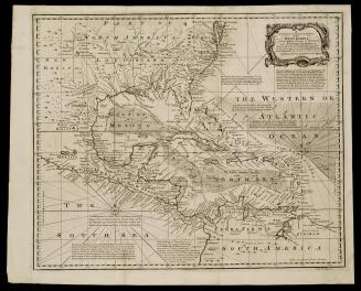
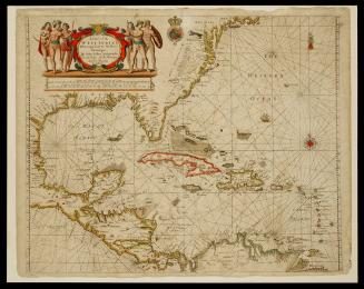
A/ NEW and ACCURATE CHART/ of the/ WEST INDIES,/ with the Adjacent Coasts of NORTH/ and SOUTH AMERICA.
1748
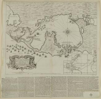
A/ New and Correct Plan of the Harbour/ of CARTHAGENA in AMERICA
1741
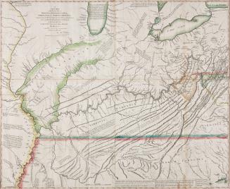
A/ NEW MAP/ of the Western Parts of/ VIRGINIA, PENNSYLVANIA,/ MARYLAND and NORTH CAROLINA;/ Comprehending the RIVER OHIO, and all the Rivers, which fall into it;/ Part of the RIVER MISSISSIPPI, the Whole of the/ ILLINOIS RIVER,/ LAKE ERIE...
1778
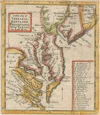
A. New Map of VIRGINIA. MARYLAND. PENSILVANIA. NEW YARSEY
1687
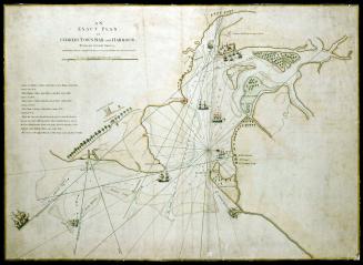
AN/ EXACT PLAN/ of/ CHARLES-TOWN-BAR and HARBOUR.
July 17, 1776
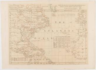
THE ATLANTIC OCEAN/ By GOVERNOR POWNALL F.R.S.
September 20, 1787
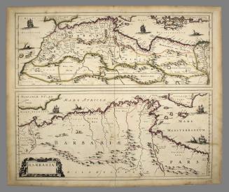
BARBARIA.
ca. 1695
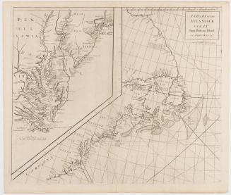
A Chart of the Atlantick Ocean From Buttons Island to Port Royall
1728
CHART of the ATLANTIC OCEAN, with the BRITISH, FRENCH, & SPANISH/ Settlements in NORTH AMERICA, and the WEST INDIES;/ as also on the Coast of AFRICA.
1768
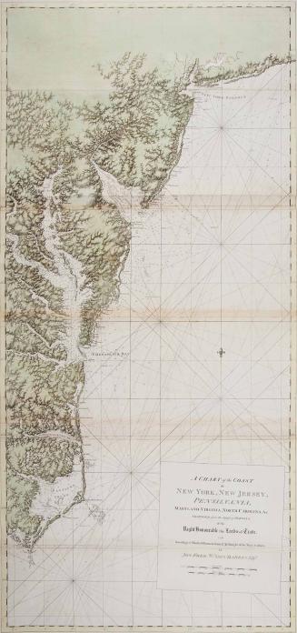
A Chart of the Coast of New York, New Jersey; Pennsilvania, Maryland, Virginia, North Carolina, &c.
1780
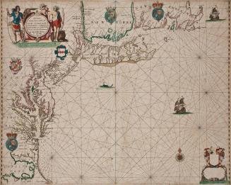
A Chart of the Sea coasts of New-England New Jarsey Virginia Maryland and Carolina From C. Cod to C. Hatteras By John Seller Hydrog'r to the King
1675
A Chart of the/ WEST INDIA'S/ From Cape Cod to the River/ Oronoque
ca. 1685
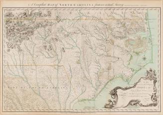
A Compleat MAP of NORTH-CAROLINA from an actual Survey.
May 1, 1770
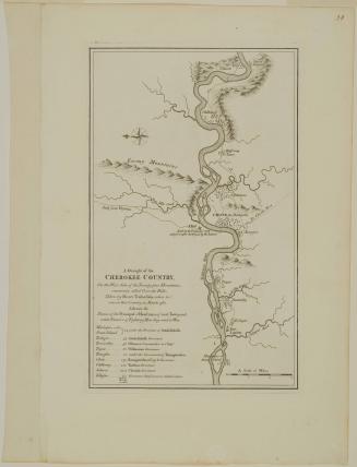
A Draught of the/ CHEROKEE COUNTRY,/ On the West Side of the Twenty four Mountains,/ commonly called Over the Hills
1768 (originally published in 1765)
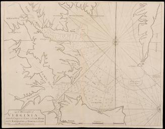
A Draught of Virginia from the Capes to York in York River and to Kuiquotan or Hamton in James River
1729
THE GENERALL HISTORIE OF Virginia, New-England, and the Summer Ifles: with the names of the Adventurers, Planters, and Governours from their firft beginning. An.o. 1584. to this prefent 1624.
1624
A General Map of North America
1762
A General Map of the Middle British Colonies
1755
Next Page