Skip to main content
Collections
The Collections
Exhibitions
Favorites
Advanced Search
Home
Works
Works
Close
Refine Results
Artist / Maker / Culture
*
William Faden (1750-1836)
(12)
Lieutenant John Hills (fl. 1777-1817)
(3)
Bernard Ratzer
(2)
Thomas Jefferys (ca. 1710-1771)
(2)
Claude Joseph Sauthier (1736-1802)
(2)
Thomas Kitchin
(1)
Thomas Jefferys & William Faden (1773-1783)
(1)
Lieutenant Thomas Hyde Page
(1)
Gerard Bancker
(1)
Lieutenant Sir Archibald Campbell
(1)
Load all
Artist / Maker / Culture
Classification(s)
*
Maps
(12)
Exhibitions
Promoting America: Maps of the Colonies and the New Republic
(1)
Date
to
Department
CWF Collection
(12)
Image Available
Origin
England, London
(12)
Sort:
Title (A–Z)
Title (Z–A)
Date (Older First)
Object number (Ascending)
Primary Maker (A-Z)
Last Updated (Ascending)
List
Images
Table
Filters
12 results
Maps
William Faden (1750-1836)
Clear All Filters
A Map of South Carolina and a part of Georgia. Containing the Whole Sea-Coast; all the Islands, Inlets, Rivers, Creeks, Parishes, Townships, Boroughs, Roads and Bridges: As Also, Several Plantations, with their proper Boundary-Lines, and the Names of the Propietors. Composed From Surveys taken by the Hon. William Bull Esq. Lieutenant Governor, Captain Gascoign, Hugh Bryan, Esq.; and William De Brahm Esqr. Surveyor General of the Southn. District of North America, Republished with considerable Additions, from the Surveys made & collected by John Stuart Esqr. His Majesty's Superintendant of Indian Affairs. By William Faden Successor to the late T. Jefferys, Geographer to the King. Charing Cross 1780.
1780
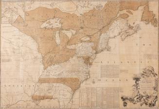
A MAP of the British and French Dominions in North America, WITH THE Roads, Distances, Limits, and Extent of the SETTLEMENTS...
1755/1774
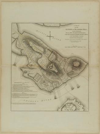
A PLAN/ OF THE/ ACTION AT BUNKERS HILL,/ on the 17th. Of June 1775./ Between HIS MAJESTY'S TROOPS,/ Under the Command of MAJOR GENERAL HOWE,/ AND THE REBEL FORCES.
1775-1778
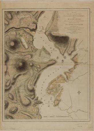
PLAN/ of the ATTACK of the FORTS/ CLINTON & MONTGOMERY,/ upon/ HUDSONS RIVER/ which were Stormed by HIS MAJESTYS FORCES/ under the Command of/ SIR HENRY CLINTON, K. B./ on the 6.th of Oct.r 1777.
1784
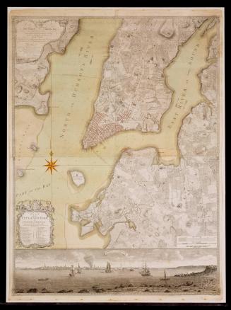
PLAN/ of the/ CITY of NEW YORK,/ in/ NORTH AMERICA:/ Surveyed in the Years 1766 & 1767.
January 12, 1776
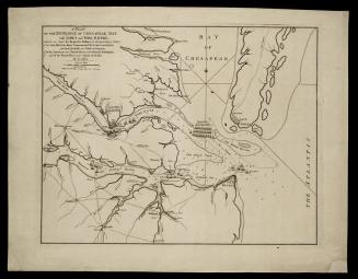
A PLAN/ OF THE ENTRANCE OF CHESAPEAK BAY,/ with JAMES and YORK RIVERS;
November 26, 1781
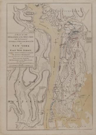
A PLAN OF THE/ OPERATIONS of the KING'S ARMY/ under the Command of/ GENERAL S.R WILLIAM HOWE, K. B./ IN/ NEW YORK/ AND/ EAST NEW JERSEY,/ against the AMERICAN FORCES Commanded/ By GENERAL WASHINGTON,
1777
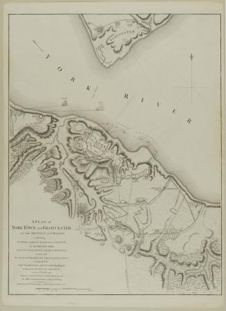
A PLAN of/ YORK TOWN AND GLOUCESTER,/ IN THE PROVINCE OF VIRGINIA,/ Shewing/ the WORKS constructed for the Defence of those Posts/ by the BRITISH ARMY,/ under the Command of Lt. Genl. EARL CORNWALLIS;
October 7, 1785
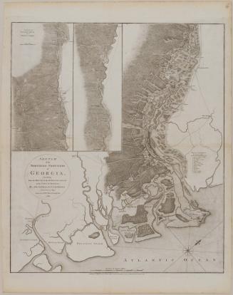
SKETCH/ of the/ NORTHERN FRONTIERS/ of/ GEORGIA,/ extending/ from the MOUTH of the RIVER SAVANNAH/ to the TOWN of AUGUSTA
1780
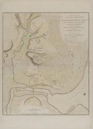
SKETCH/ of the POSITION of the BRITISH FORCES/ at/ ELIZABETH TOWN POINT/ after their RETURN from CONNECTICUT FARM,/ in the PROVINCE of EAST JERSEY:/ under the Command of/ HIS EXCELL.Y LEIUTN.T GEN.L KNYPHAUSEN,/ on the 8.th June 1780.
1784
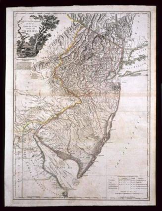
THE/ PROVINCE of NEW JERSEY,/ Divided into/ EAST and WEST,/ commonly called/ THE JERSEYS.
December 1, 1777
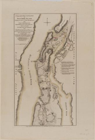
A Topographical MAP of the North.n Part/ OF/ NEW YORK ISLAND,/ Exhibiting the PLAN of FORT WASHINGTON,/ now/ FORT KNYPHAUSEN,/ with the Rebels Lines to the Southward,/ which were Forced by/ the Troops under the Command of/ THE/ R.t Hon.ble EARL PERCY...
1777
Next Page