Skip to main content
Collections
The Collections
Exhibitions
Favorites
Advanced Search
Home
Works
Works
Close
Refine Results
Artist / Maker / Culture
*
Herman Moll (1654?-1732)
(11)
Thomas Bowles II
(3)
John King
(3)
Philip Overton
(2)
John Bowles
(2)
John Bowles and Son
(1)
Johann Baptist Homann (1663-1724)
(1)
Classification(s)
*
Maps
(11)
Exhibitions
More than Meets the Eye: Maps and Prints of Early America
(1)
Promoting America: Maps of the Colonies and the New Republic
(1)
Date
to
Department
CWF Collection
(11)
Image Available
Origin
England, London
(10)
Europe, Germany, Nuremberg
(1)
Sort:
Title (A–Z)
Title (Z–A)
Date (Older First)
Object number (Ascending)
Primary Maker (A-Z)
Last Updated (Ascending)
List
Images
Table
Filters
11 results
Maps
Herman Moll (1654?-1732)
Clear All Filters
C. Virginia und Maryland
1737
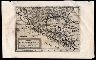
A Map of Mexico or New Spain Florida now called Louisiana and Part of California & c.
1708
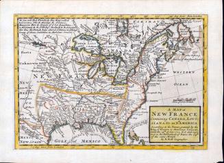
A MAP of/ NEW FRANCE/ Containing CANADA, LOUI=/SIANA &c. in N.th AMERICA.
1712-1730
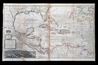
A MAP of the/ WEST-INDIES/ or the Islands of AMERICA/ in the NORTH SEA; with y.e adjacent/ Countries; explaining what belongs to SPAIN,/ ENGLAND, FRANCE, HOLLAND &c.
1740-1745 (originally published 1715)
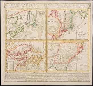
A New and Exact MAP of the DOMINIONS/ of the KING of GREAT BRITAIN/ on y.e Continent of NORTH AMERICA.
After 1735; originally published 1715
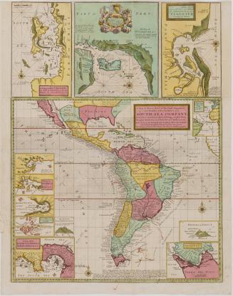
A New & Exact MAP of the Coast, Countries/ and Islands within y.e LIMITS of y.e/ SOUTH SEA COMPANY,/ from y.e River Aranoca to Terra del Fuego, and from thence/ through y.e South Sea to y.e North Part of California &c.
ca. 1740 (originally published 1711)
A New MAP of the North Parts of/ AMERICA claimed by FRANCE/ under y.e Names of LOUISIANA, MISSISSIPI, CANADA and/ NEW FRANCE with y.e Adjoyning Territories of ENGLAND and SPAIN.
1720
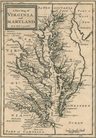
A New Map of Virginia and Maryland
1708
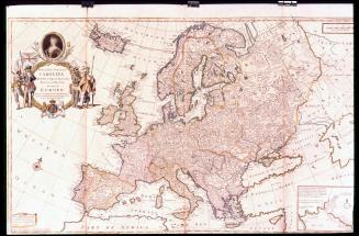
To Her most Sacred MAJESTY/ CAROLINA/ QUEEN of GREAT BRITAIN,/ FRANCE & IRELAND./ This MAP of/ EUROPE/ According to the Newest and most Exact Observations...
ca. 1732-1748
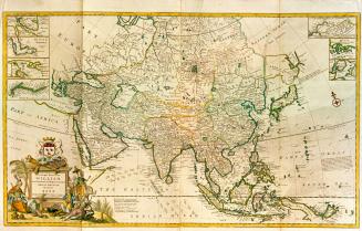
To the Right Honourable/ WILLIAM/ Lord Cowper, Lord High CHANCELLOR of/ GREAT BRITAIN./ This MAP of/ ASIA/ According to y.e Newest/ and most Exact Observations is/ most Humbly Dedica/ ted by your Lordship's most Humble/ Servant/ Herman Moll Geographer.
1715-1718
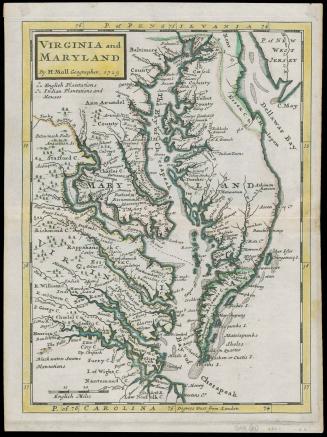
VIRGINIA and/ MARYLAND
1729 (originally published 1708)
Next Page