Skip to main content
Collections
The Collections
Exhibitions
Favorites
Advanced Search
Home
Works
Works
Close
Refine Results
Artist / Maker / Culture
*
Lewis Evans (ca. 1700-1756)
(7)
James Turner (1722-1759)
(6)
Robert Dodsley
(2)
James Alexander
(1)
Classification(s)
*
Maps
(7)
Exhibitions
More than Meets the Eye: Maps and Prints of Early America
(1)
Date
to
Department
CWF Collection
(7)
Image Available
Origin
America, Massachusetts, Boston
(3)
America, Pennsylvania, Philadelphia
(2)
America, Pennsylvania
(1)
England, London
(1)
Sort:
Title (A–Z)
Title (Z–A)
Date (Older First)
Object number (Ascending)
Primary Maker (A-Z)
Last Updated (Ascending)
List
Images
Table
Filters
7 results
Maps
Lewis Evans (ca. 1700-1756)
Clear All Filters
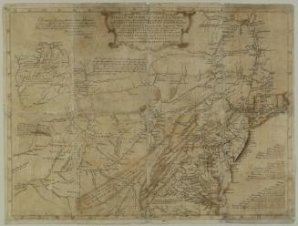
A General Map of the Middle British Colonies
1755
A general MAP of the/ MIDDLE BRITISH COLONIES, in AMERICA;/ Viz VIRGINIA, MÀRILAND, DÈLAWARE, PENSILVANIA,/ NEW-JERSEY, NEW-YORK, CONNECTICUT, and RHODE ISLAND...
1755
A general Map of the/ MIDDLE BRITISH COLONIES, in AMERICA,/. Viz VIRGINIA, MARILAND, DELAWARE, PENSILVANIA,/ NEW JERSEY, NEW YORK, CONNECTICUT, and RHODE ISLAND:
1755
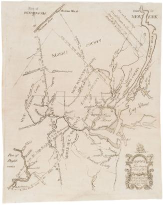
Map No. III (Map of New Jersey)
1747
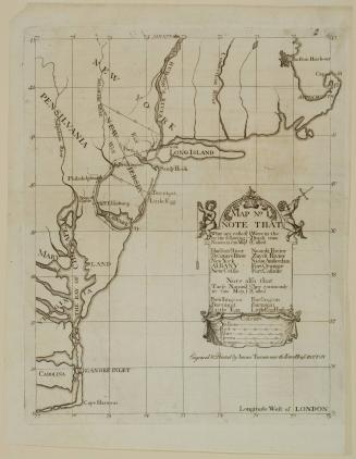
Map No. II (Map of New York and New Jersey)
1747
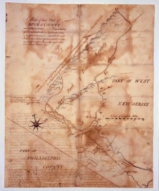
A Map of that Part of/ BUCKS COUNTY/ released by the Indians to the Proprietaries/ of Pensilvania in September 1737 ("Walking Purchase Map")
1737-1738
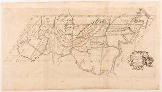
New York, Pennsylvania, Maryland, Virginia, and Carolina (no title)
1747
Next Page