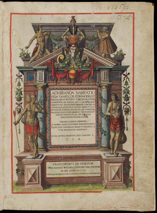
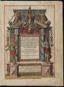
Admiranda Narratio fida tamen, de Commodis et Incolarum Ritibus Virginiae (A Briefe and True Report of the New Found Land of Virginia)
Date1590
Designed and engraved by
Theodor De Bry
(1528 - 1598)
After work by
John White
(fl. 1585 - 1593)
Primary Author
Thomas Hariot
(1560-1621)
MediumLine engraving on laid paper hand coloring. Letterpress. Bound in calf binding.
DimensionsOW: 12" x OH: 16 1/4" (Book closed)
Credit LineGift of Mr. and Mrs. Richard F. Barry, III, Mr. and Mrs. Macon F. Brock, Mr. and Mrs. David R. Goode, Mr. and Mrs. Conrad M. Hall, Mr. and Mrs. Thomas G. Johnson, Jr., Mr. and Mrs. Charles W. Moorman, IV, and Mr. and Mrs. Richard D. Roberts
Object number2017-194,1
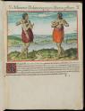
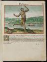
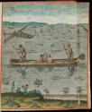
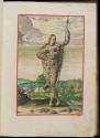
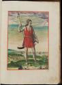
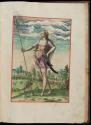
DescriptionFully illustrated copy with gold highlights bound in late 17th century calf, blind-paneled with fleuron cornerpieces and the initials 'RT' of the (likely) original owner Richard Turbutt. Missing map 18, 'Indian Dance.'Label TextDe Bry published White's map and engravings with Thomas Hariot's 'A briefe and true report of the new found land of Virginia.' Many of White's original drawings are in the British Museum.
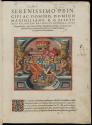
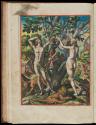
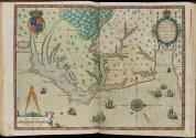
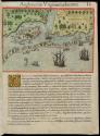
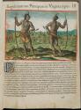
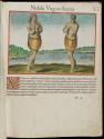
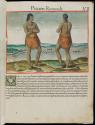
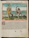
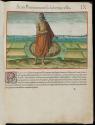
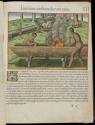
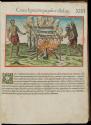
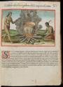
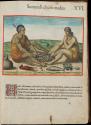
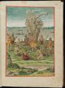
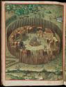
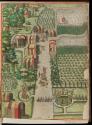
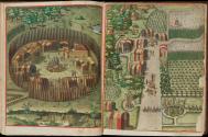
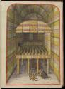
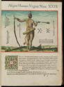
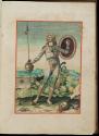
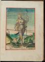
De Bry’s engravings portray Virginia as a latter-day Eden, perhaps to stimulate interest in settlement. The Native American “Town of Secota” depicts such a scene, showing an abundance of thriving crops in neatly ordered gardens carefully manicured by a Native population. The map of 'Americae Pars, Nume Virginia' drawn by John White and engraved by de Bry provides the first printed English record of Sir Walter Raleigh’s attempts to plant a colony in the New World. Although described in the title as Virginia, it delineates the region between the mouth of the Chesapeake Bay and Cape Lookout, North Carolina.
In 1584, Queen Elizabeth I granted Sir Walter Ralegh a charter enabling him to settle an English colony in America. Ralegh promptly dispatched two ships under the leadership of Captains Arthur Barlowe and Philip Amadas, who were directed to reconnoiter the area above Spanish Florida. On a second trip to America led by Sir Richard Granville the following year, the colonists established their headquarters on Roanoke Island on the Outer Banks of North Carolina, naming the region Virginia. John White and Thomas Hariot were important members of the group.1 Although little is known of his background as an artist, White was sent to draw and record the geography, natives, and natural history of the area. Hariot's experience as a surveyor and writer complemented White's artistic renderings. Educated at Oxford University, Hariot was perhaps the most renowned English mathematician of his time. During the year the two spent at Roanoke Island fort, they gathered a substantial amount of information about the inhabitants, the flora and fauna, and the terrain.
1. White appears to have made five voyages to the New World.
2. The only inlet that has remained open over the 400 years since this map was published is Okracoke, identified as "Wokokon" on White's map.
3. Hariot was to study the Algonquian language and Native American customs in addition to the geography and natural resources of the area. Cumming, Mapping the North Carolina Coast, (Raleigh, N. C., 1988), p. 51.
This copy is published in William C. Wooldridge, "Mapping Virginia: From the Age of Exploration to the Civil War" (Charlottesville: University of Virginia Press, 2012), Maps 7a-h, pp. 9-15.
1755-1770

ca. 1730 (Yongzheng period)
1760-1780
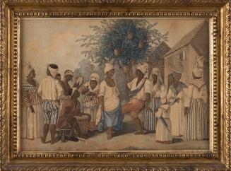
ca. 1845
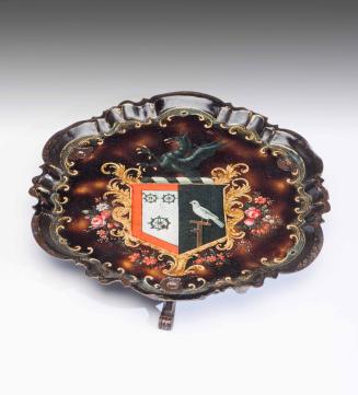
1820-1830
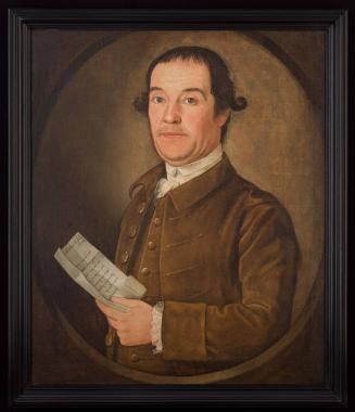
1680-1700