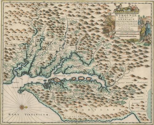
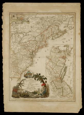
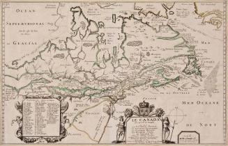
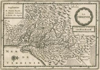
VIRGINIE,/ Grande Region de l'/ AMERIQUE/ SEPTENTRIONALE
Date1729
Maker
Pieter van der Aa
(1659 - 1733)
MediumBlack and white line engraving on laid paper with period color
DimensionsOH: 14 5/16" x OW: 18 1/16"
Credit LineMuseum Purchase
Object number2017-54
DescriptionThe cartouche reads: "VIRGINIE,/ Grande Region de l'/ AMERIQUE/ SEPTENTRIONALE,/ avec tous ses Bourgs, Hameaux, Rivieres/ et Bayes, suivant les recherches exactes/ de ceux qui l'ont decouverte, et nouvellement/ mise au jour par/ PIERRE VANDER AA,/ Marchand Libraire A LEIDE."The scale reads: "Lieues d'Allemagne de 15 au Degre./ Lieues de France de 20 au Degre."
Label TextThe map shows the same geographical configuration illustrated by John Smith's map of Virginia (1612 - see 2017-197) making this Derivative 8, State 2. Smith's map, was subsequently copied by many including Arnoldus Montanus (Amsterdam, 1671 - See 2017-53) and John Ogilby who published Montanus' plate in England that same year. Low Country artist, Pieter van der Aa, purchased the plate from Ogilby and reissued it 58 years later by removing parts of the original plate and inserting new material. This map is important because it continues to show how important the Smith map was even one hundred years after it was first issued. The map appeared in Van der Aa's atlas "La Galerie Agreable du Monde..."
This copy is published in William C. Wooldridge, "Mapping Virginia: From the Age of Exploration to the Civil War (Charlottesville: University of Virginia Press, 2012), 47-48, #41.
1628/1714?