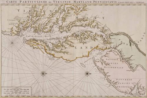
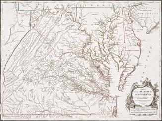
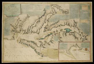
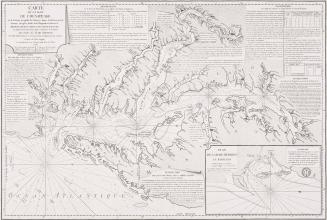
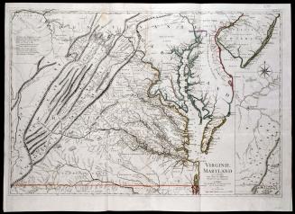
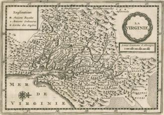
CARTE PARTICULIERE DE VIRGINIE, MARYLAND, PENNSILVANIE, La Nouvelle JARSEY Orient et Occidentale
Date1700
Publisher
Pierre Mortier (1661-1711)
MediumBlack and white line engraving with period color
DimensionsOH: 38 1/2" x OW: 25 1/4"
Credit LineMuseum Purchase
Object number2017-82
DescriptionThe upper margin reads: "CARTE PARTICULIERE DE VIRGINIE, MARYLAND, PENNSILVANIE, La Nouvelle JARSEY Orient et Occidentale."The scale in the lower right corner reads: "Echelle/ Lieues de France et d'Angleterre./ Lieues d'Allemagne./ Lieues d'Espagne et de Portugal./ A Amsterdam Chez P. Mortier, Avec Privilege."
Label TextPrinted in four sections and frequently hand-colored, this magnificent chart may have been intended more as a showpiece than as a working chart. This map appeared in Pierre Mortier's "Suite de Neptune Francois," 1700. This example is the first state of this map. This map is thought to be the work of either Nicholas Sanson or A.H. Jaillot. It is largely based on a very important and rare map of Virginia and Maryland by Augustine Herrman, published in 1673. The chart includes soundings in the bays and rivers.
This copy published in William C. Wooldridge, Mapping Virginia: From the Age of Exploration to the Civil War (Charlottesville: University of Virginia Press, 2012), pp. 72-73, #65.
1628/1714?