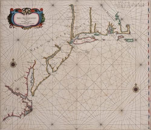
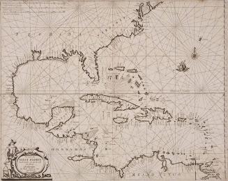
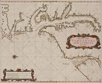
Pascaarte van Nieu Nederlandt uytgegeven door Arnold Colom t'Amsterdam opt Water by de Nieuwe brugh in de Lichtende Colom
Date1658
Maker
Arnold Colom
(1624 - 1668)
MediumBlack and white line engraving with period color
DimensionsOH: 22 1/6" x OW: 25 5/16"
Credit LineMuseum Purchase
Object number2017-66
DescriptionCartouche reads: "Pascaarte/ van/ NIEU NEDERLANDT/ uytgegeven/ door/ Arnold Colom./ t'Amsterdam/ opt Water by Nieuwe brugh in de Lich.tnde/ Colom."Pagination: 16
Label TextThis chart was included in Arnold Colom's important sea atlas, "Zee-Atlas, ofte Water-Wereldt" first published in 1656. The large format, up-to-date cartographic information, and ornate decoration made this atlas one of the most notable Dutch atlases ever produced. It is an example of the third state. The corresponding map of the southeast is represented by 2017-67.
This copy published in William C. Wooldridge, "Mapping Virginia: From the Age of Exploration to the Civil War" (Charlottesville: University of Virginia Press, 2012), #55, p. 61.
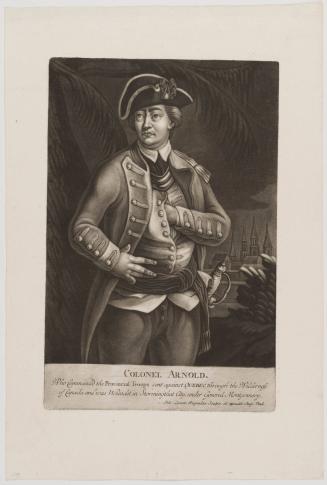
ca. 1776
1824-1828 (range of the entires in the album).