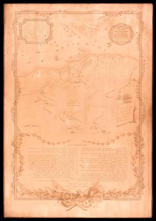

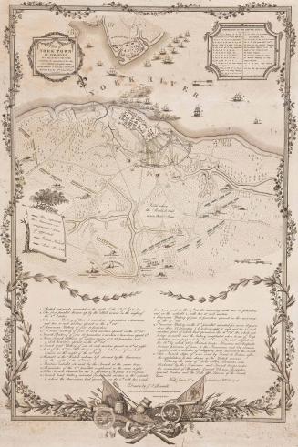
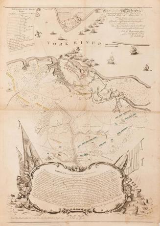
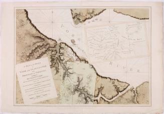
Copper plate: Plan of/ YORK TOWN/ IN VIRGINIA/ AND ADJACENT COUNTRY,/ Exhibiting the operations of the Am-/ erican French & English armies/ during the Siege of that place in Oct. 1781./ Surveyed from the 22.nd to the 26.th Oct.r
Date1823
Artist/Maker
Benjamin Tanner (1775-1848)
After work by
John Francis Renault
(d. 1824)
After work by
Sebastian Bauman
(1739 - 1803)
MediumCopper
Dimensions33 1/2" x 23"
Credit LineMuseum Purchase
Object number1976-63,1
DescriptionThe upper left cartouche reads: "Plan of/ YORK TOWN/ IN VIRGINIA/ AND ADJACENT COUNTRY,/ Exhibiting the operations of the Am-/ erican French & English armies/ during the Siege of that place in Oct. 1781./ Surveyed from the 22.nd to the 26.th Oct.r"Label TextThis copper plate was engraved by Benjamin Tanner in Philadelphia between 1818 and 1823. The resulting map was first advertised in 1823 along with a print of the surrender at Yorktown after the work of John Francis Renault. (see 1986-122). Renault began advertising a print to commemorate the battle of Yorktown in 1803. Though there is no evidence to substantiate the claim, Renault stated on the print that he was present at the battle and served as the secretary to the Comte de Grasse. The mysterious artist spent nearly 20 years acquiring subscriptions for the print until he was implicated by several newspapers in Virginia and North Carolina as a fraud. Renault finally settled on Benjamin Tanner to serve as the engraver for his ambitious work.
The firm of Tanner, Vallence, Kearny, & Company dissolved in 1819, after the plate's completion. One of the partners, Benjamin Tanner (1775-1848) took the plate and finally published the print in 1823 along with this map of the Yorktown battlefield purported to be an original design by Renault (see 2017-242). The map was actually a copy of a 1782 map by Major Sebastian Bauman with decorative embellishments by Renault and Tanner. The timing of the print's publication can be attributed to the Marquis de Lafayette's 1823-1824 tour of America and the death of Renault five months prior.
MarkingsText below the key reads: "Drawn by J.n F. Renault./ with a Crow-pen and presented to the MARQUIS DE LA FAYETTE./ Engraved by B. Tanner."
ProvenancePlates were owned by Mrs. Ann Hardy of Newport, Rhode Island. She offered them to the Virginia Independence Bicentennial Commission in 1973. Colonial Williamsburg purchased them from the VIBC.

May 12, 1794
May 6, 1778