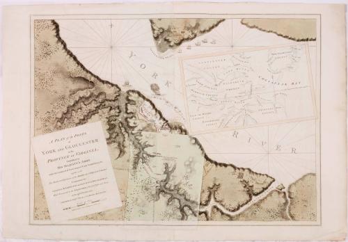
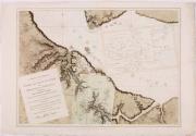
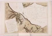
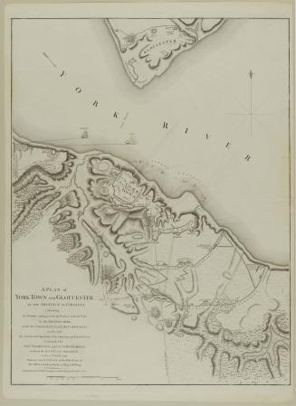
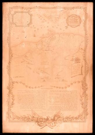
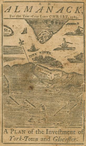
A Plan of the Posts at York and Gloucester in the Province of Virginia
Date1782
Publisher
Joseph Frederick Wallet Des Barres
(1721 - 1824)
Cartographer
Captain Edward Fage
OriginEngland, London
MediumBlack and white line engraving with period hand color on laid paper
DimensionsOverall: 74.6 x 102.2cm (29 3/8 x 40 1/4in.)
Credit LineMuseum Purchase, The Friends of Colonial Williamsburg Collections Fund
Object number2015-187
DescriptionThe bottom left cartouche reads: "A PLAN of the POSTS/ of/ YORK AND GLOUCESTER/ in the/ PROVINCE OF VIRGINIA,/ Established by/ HIS MAJESTY'S ARMY / under the Command of Lieut.t General EARL CORNWALLIS,/ together with/ The Attacks and Operations of the AMERICAN & FRENCH FORCES/ Commanded by/ GENERAL WASHINGTON and the COUNT of ROCHAMBEAU,/ Which Terminated in the SURRENDER of the said Posts and Army/ on the 17.th of October 1781./ SURVEYED by CAPT.N FAGE of the ROYAL ARTILLERY./ Publish'd according to Act of Parliament the 4.th June 1781."Label TextWhile the French navy under Admiral de Grasse was attempting to block the mouth of the Chesapeake Bay, Washington and Rochambeau were bringing the Franco-American troops to Virginia. Traveling in advance of the main army, the generals arrived at Lafayette's camp in Williamsburg on September 14. They impressed upon Lafayette the necessity of ensuring that Cornwallis remain confined at Yorktown. Surprisingly, Cornwallis took no action. By September 26, the French and American forces had reached the capital. Two days later, the march to Yorktown began.
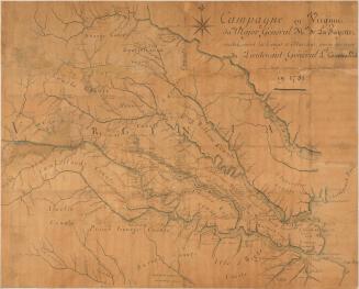
Yorktown was built on a bluff at a point where the York River is about one-half mile wide. Although painted almost thirty years earlier, A View of the Town of York Virginia from the River appears to be an accurate depiction of the city's appearance.1Yorktown Creek to the northwest and Wormsley Creek to the southeast created natural ravines. Cornwallis constructed seven inner redoubts and six battery positions joined by a series of entrenchments that together formed a semicircular curve southeast of the city. The primary strongpoint of this inner line of fortifications was known as the "horn work." Beyond the inner line were three more redoubts located in the ravines (Pigeon Quarter), the Fusilier redoubt to the west along the Williamsburg Road, and redoubts 9 and 10 to the southeast. Across the river at Gloucester Point, Cornwallis established a support site with four redoubts and three batteries, also connected by entrenchments. Frigates Guadeloupe and Charon, each with forty-four guns, and three transports were anchored in the river.
By October 6, the allies were prepared for battle. To divert attention from the Americans constructing the first parallel south of Yorktown, the French positioned themselves west of the Fusilier redoubt. The French were extended the courtesy of firing the first round on October 9. Washington himself fired the first American round from the south. The next day, four more allied batteries joined in the action, causing significant damage to the British army's ability to return fire. The Charon and two other vessels were destroyed by French hot shot. On October 14, Washington attacked British redoubts 9 and 10. Both were captured without counterattack, refortified, and tied into the Americans' second parallel.
In desperation Cornwallis attempted to spike the enemy's guns, which he ordered Lieutenant Colonel Robert Abercromby to do. Abercromby ineffectively spiked six cannon, but the Americans quickly put them back in order. Fage recorded this maneuver as Sally made by the British against these Batterys Oct.r 16. The second parallel was complete.
Cornwallis attempted to ferry his army across the York River to Gloucester Point during the night of October 16-17; however due to severe weather only one advance force was transported. Cornwallis was stranded in Yorktown. On October 17, the allied forces opened with heavy bombardments. The British were unable to answer. Between nine and ten o'clock that morning, a redcoated drummer and a soldier waving a handkerchief signaled Cornwallis's intention to surrender.
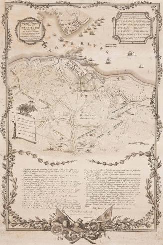
Edward Fage, who had been at the Royal Military Academy at Woolwich, illustrated the troop, redoubt, and battery positions of the allied and British armies around Yorktown on the main portion of the map. An accompanying overlay pinpointed positions of the British troops in the ravines as the allies approached the enemy on September 28 and 29. A Plan of the Posts of York and Gloucester is one of a handful of battle plans that Joseph Frederick Wallet Des Barres published in his Atlantic Neptune.
1. Although the artist is unknown, the watercolor was probably painted by an officer on board the Success or Norwich. Both ships were in the fleet in the York River in 1755. A traveler described the city in 1736. "I should just mention the battery, that is the defense of the town, which at this time was under the direction of an awkward engineer, by trade a barber, and is as despicably contrived for the safety of the place as it, no doubt, would be conducted in time of danger. Indeed, Virginia is quite an open country to the incursions of an enemy, having little to resist an attack by sea." "Observations in several voyages and travels in America in the year 1736" in E. G. Swem, "Views of Yorktown and Gloucester Town, 1755," VMHB, LIV (1946), p. 102, and 101, n. 3.


1765-1770
ca. 1825