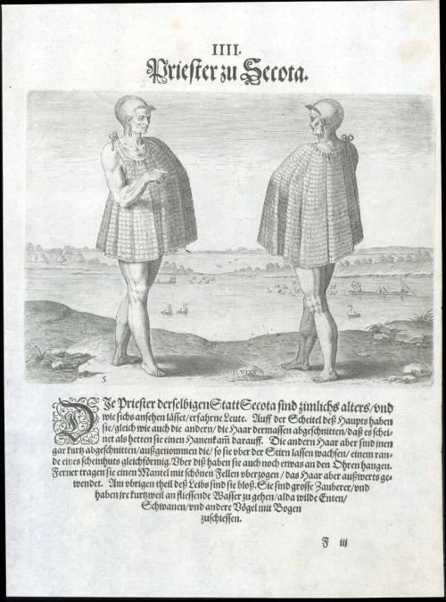
A Secotan Priest
Date1590-1600
Made under direction of
Theodor De Bry
(1528 - 1598)
Engraver
Gysbert Van Veen
Primary Author
Thomas Hariot
(1560-1621)
Maker
John White
(fl. 1585 - 1593)
MediumLine engraving on laid paper with letterpress
DimensionsOverall: 12 3/8 × 9in. (31.4 × 22.9cm)
Credit LineMuseum Purchase
Object number1983-286,5
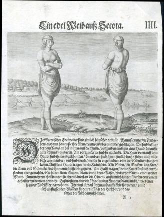
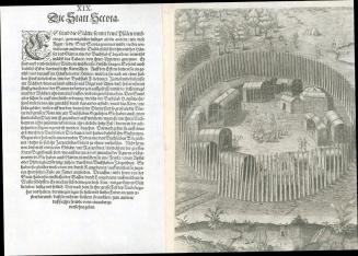
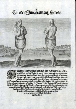
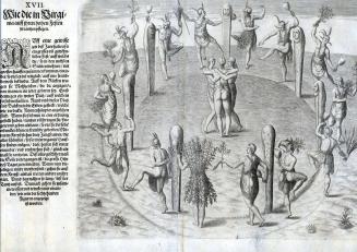
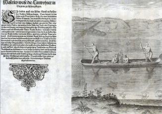
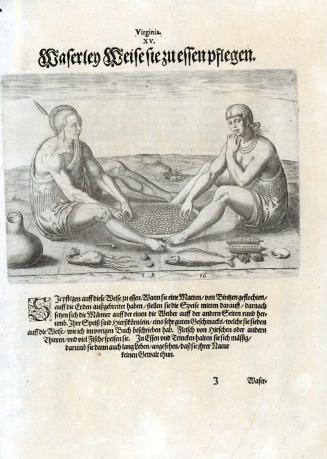
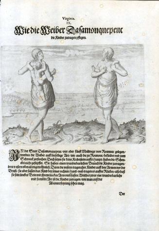
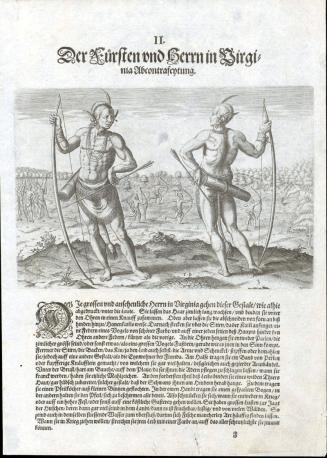
DescriptionUpper part of the page reads: "IIII. Priester zu Secota."Label TextThis plate, engraved by Gysbert Van Veen and published by Theodor De Bry, depicts a Europeanized vision of Carolina Algonquians based on the watercolors by John White and using the written descriptions by Thomas Hariot. In 1590, De Bry published Hariot's text with engravings based on White's watercolors in a book entitled 'A briefe and true report of the new found land of Virginia' which was published in English, French, German, and Latin.1 The book provides the first printed English record of Sir Walter Ralegh’s attempts to plant a colony in the New World. Although described in the title as Virginia, it delineates the region between the mouth of the Chesapeake Bay and Cape Lookout, North Carolina.2
The text accompanying this page is the German translation, possibly from the second or third edition, that from a European perspective, describes the dress, bodily adornments, hairstyles, and role of a Carolina Algonquian priest from the town of Secota. Portions of the text read (this translation from the Latin edition): "The priests of that same town, SECOTA, are quite old and, it seems, fairly knowledgable. They have hair in a crest at the top of the head, as the other men do, but the rest is clipped shirt, except for the hair that grows out over the forehead like the brim of a hat...They are famous magicians, and for the sake of pleasure they often go to the rivers with bows to seek out and capture wood ducks, swans, and other birds." 3
In 1584, Queen Elizabeth I granted Sir Walter Ralegh a charter enabling him to settle an English colony in America. Ralegh promptly dispatched two ships under the leadership of Captains Arthur Barlowe and Philip Amadas, who were directed to reconnoiter the area above Spanish Florida. On a second trip to America led by Sir Richard Granville the following year, the colonists established their headquarters on Roanoke Island on the Outer Banks of North Carolina, naming the region Virginia. John White and Thomas Hariot were important members of the group.4 Although little is known of his background as an artist, White was sent to draw and record the geography, natives, and natural history of the area.5 Hariot's experience as a surveyor and writer complemented White's artistic renderings. Educated at Oxford University, Hariot was perhaps the most renowned English mathematician of his time. During the year the two spent at Roanoke Island fort, they gathered a substantial amount of information about the inhabitants, the flora and fauna, and the terrain.
1. Only the Latin and German editions went onto second and third editions, while the English and French translations were only published in 1590; see Peter Stallybrass, "Admiranda narratio: A European Best Seller," in A brief and true report of the new found land of Virginia, thomas Hariot, The Theodore de Bry Latin Edition, Facsimile edition accompanied by the modernized English text (Published for the Library at the Mariner's Museum by the University of Virginia Press, Charlottesville and London, 2007), 9-30.
2. Margaret Beck Pritchard, and Henry G. Taliaferro, "Degrees of Latitude: Mapping Colonial America" (New York: Colonial Williamsburg Foundation, 2002), no. 2.
3. A brief and true report of the new found land of Virginia, thomas Hariot, The Theodore de Bry Latin Edition, Facsimile edition accompanied by the modernized English text (Published for the Library at the Mariner's Museum by the University of Virginia Press, Charlottesville and London, 2007)
4. White appears to have made five voyages to the New World.
5. Hariot was to study the Algonquian language and Native American customs in addition to the geography and natural resources of the area. Cumming, Mapping the North Carolina Coast, (Raleigh, N. C., 1988), p. 51.
1590-1600
1590-1600
1590-1600

1590-1620
1590-1600
1590-1600
Ca. 1730