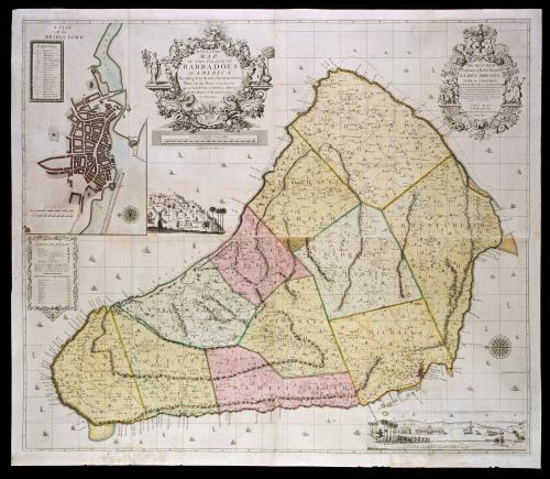
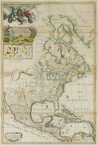
A New & Exact/ MAP/ OF THE ISLAND OF/ BARBADOES/ IN AMERICA/ According to an Actual & Accurate Survey/ Made in the Years 1717 to 1721/ Approved by the ROYAL SOCIETY & Authorized/ BY HIS MAJESTY'S ROYAL LICENCE
Date1722
Cartographer
William Mayo (b. 1684)
Engraver
John Senex (1678-1740)
OriginEngland, London
MediumBlack and white line engraving with period hand color on laid paper
DimensionsOH: 37 1/4" x OW: 44 1/8"
Credit LineMuseum Purchase
Object number1996-7
DescriptionThe upper left cartouche reads: "A New & Exact/ MAP/ OF THE ISLAND OF/ BARBADOES/ IN AMERICA/ According to an Actual & Accurate Survey/ Made in the Years 1717 to 1721/ Approved by the ROYAL SOCIETY & Authorized/ BY HIS MAJESTY'S ROYAL LICENCE/ By William Mayo."The text below the cartouche reads: "Engrav'd by Iohn Senex 1722."
The upper right cartouche reads: "TO/ THE MOST HIGH/ Puissant & Noble PRINCE/ IAMES BRUGES/ DUKE OF CHANDOS/ MARQUIS AND EARL OF CAERNARVON/ Viscount Chandos of WIlton in Hereford-shire, Baron Chandos of Sudley/ Castle in Glocester-shire, Lord Lieutenant & Custos Rotulorum of the/ Counties of HEREFORD & RADNOR, High Steward of the/ City of Hereford, Corporation of Leominster and of Cantemolenis in/ the County of Radnor, Governour of the Turkey Company, One of/ his Majesty's most Honourable Privy Council, and One of the/ Governours of the Charter House,/ THIS MAP/ is Dedicated by/ His most humble & most Obedient Servant/ William Mayo."
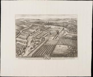
Label TextThe climate and soil of Barbados were well suited for plantations. The location also provided a convenient base from which the English could launch plundering expeditions against the Spanish in the West Indies and South America. Landowners initially attempted to grow tobacco and cotton, but by the 1650s, they began to experiment with the production of sugar cane. This crop proved so profitable that within thirty years, Barbados had become the richest of all the English colonies in America, with total exports greater than those from all of the other New World colonies combined.
William Mayo’s map identified approximately 986 plantations, designating the size of their operation by recording the number of windmills each required to process sugar cane. The windmills ranged from one to three, with three symbolizing the largest plantations. Mayo used a representation of a small dwelling to denote the less profitable plantations that produced cotton, ginger, and ground provisions.


1725