Skip to main content
Collections
The Collections
Exhibitions
Favorites
Advanced Search
Home
Search Objects
Search
Objects
(12,491)
People
(26,330)
Exhibitions
(56)
Close
Refine Results
Artist / Maker / Culture
*
Emanuel Bowen
(6)
Samuel Bladon
(1)
Andrew Millar (1707-1768)
(1)
Thomas Osborne (d. 1767)
(1)
John Rivington I
(1)
B. Law and Company
(1)
Thomas Longman
(1)
C. Ware
(1)
John Gibson (fl. 1750-1792)
(1)
Robert Sayer (1725-1794)
(1)
Load all
Artist / Maker / Culture
Classification(s)
*
Maps
(6)
Date
to
Department
CWF Collection
(6)
Image Available
Origin
*
England, London
(6)
Sort:
Relevance
Title (A–Z)
Date (Older First)
Object number (Ascending)
Primary Maker (A-Z)
Last Updated (Ascending)
List
Images
Table
Filters
6 results for
*
Result type
Objects
People
Exhibitions
Maps
England, London
Emanuel Bowen
Clear All Filters
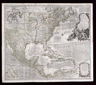
AN/ Accurate/ MAP/ OF/ NORTH AMERICA./ Describing and distinguishing the/ BRITISH and SPANISH/ Dominions on this great Continent;/ According to the Definitive Treaty/ Concluded at Paris 10.th Feb.y 1763.
1775 (originally published 1755)
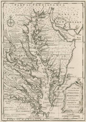
A New and/ ACCURATE MAP/ of VIRGINIA &/ MARYLAND...
1752
THE/ MAPS AND CHARTS/ TO THE/ MODERN PART/ OF THE UNIVERSAL HISTORY.
1766
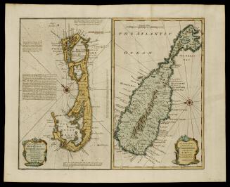
A NEW & ACCURATE MAP/ of/ BERMUDAS/ or/ SOMMERS ISLANDS,/ AN ACCURATE MAP/ of the ISLAND of/ S.T CHRISTOPHER,/ vulgarly called/ S.T KITS,
1748
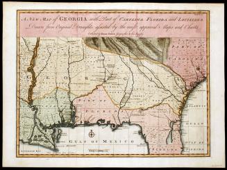
A NEW MAP of GEORGIA, with Part of CAROLINE, FLORIDA and LOUISIANNA.
1748
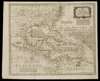
A/ NEW and ACCURATE CHART/ of the/ WEST INDIES,/ with the Adjacent Coasts of NORTH/ and SOUTH AMERICA.
1748
Next Page