Skip to main content
Collections
The Collections
Exhibitions
Favorites
Advanced Search
Home
Search Objects
Search
Objects
(12,471)
People
(26,327)
Exhibitions
(56)
Close
Refine Results
Artist / Maker / Culture
William Faden (1750-1836)
(12)
Herman Moll (1654?-1732)
(10)
Thomas Jefferys (ca. 1710-1771)
(10)
Robert Sayer (1725-1794) & John Bennett (fl. 1760-1787)
(10)
Robert Morden (d. 1703)
(9)
Emanuel Bowen
(6)
Robert Sayer (1725-1794)
(6)
Thomas Bowles II
(5)
Captain John Smith (1580-1631)
(5)
John Seller
(4)
Load all
Artist / Maker / Culture
Classification(s)
*
Maps
(122)
Sewing Accessories
(1)
Exhibitions
Promoting America: Maps of the Colonies and the New Republic
(9)
More than Meets the Eye: Maps and Prints of Early America
(8)
A Rich and Varied Culture
(2)
Date
to
Department
CWF Collection
(122)
Image Available
Origin
*
England, London
(122)
Sort:
Relevance
Title (A–Z)
Date (Older First)
Object number (Ascending)
Primary Maker (A-Z)
Last Updated (Ascending)
List
Images
Table
Filters
122 results for
*
Result type
Objects
People
Exhibitions
Maps
England, London
Clear All Filters
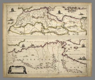
BARBARIA.
ca. 1695
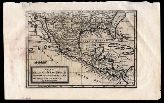
A Map of Mexico or New Spain Florida now called Louisiana and Part of California & c.
1708
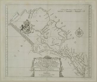
A SURVEY of the NORTHERN NECK/ of VIRGINIA, being/ The LANDS belonging to the R.t Honourable/ THOMAS LORD FAIRFAX BARON CAMERON, bounded/ by & within the Bay of Chesapoyocke and between/ the Rivers Rappahannock and Potowmack:
1745
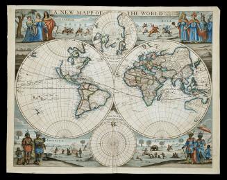
A NEW MAPP/ OF THE WORLD
1676
A New MAP of the North Parts of/ AMERICA claimed by FRANCE/ under y.e Names of LOUISIANA, MISSISSIPI, CANADA and/ NEW FRANCE with y.e Adjoyning Territories of ENGLAND and SPAIN.
1720
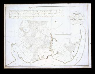
A/ Map/ of/ General Washington's Farm,/ of/ MOUNT VERNON/ from/ A Drawing transmitted by the General.
1801
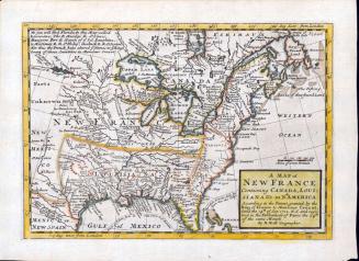
A MAP of/ NEW FRANCE/ Containing CANADA, LOUI=/SIANA &c. in N.th AMERICA.
1712-1730
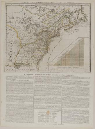
THE THEATRE OF WAR in NORTH AMERICA, with the ROADS and A TABLE OF THE DISTANCES.
March 20, 1776
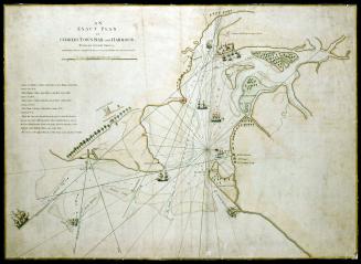
AN/ EXACT PLAN/ of/ CHARLES-TOWN-BAR and HARBOUR.
July 17, 1776
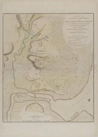
SKETCH/ of the POSITION of the BRITISH FORCES/ at/ ELIZABETH TOWN POINT/ after their RETURN from CONNECTICUT FARM,/ in the PROVINCE of EAST JERSEY:/ under the Command of/ HIS EXCELL.Y LEIUTN.T GEN.L KNYPHAUSEN,/ on the 8.th June 1780.
1784
A MAP of/ SOUTH CAROLINA/ And a PART of/ GEORGIA./ containing the Whole/ Sea-Coast; all the Islands, Inlets, Rivers, Creeks, Parishes,/ Townships, Boroughs, Roads, and Bridges:/ AS ALSO,/ Several Plantations, with their proper Boundary-Lines...
1757
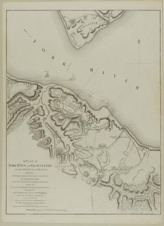
A PLAN of/ YORK TOWN AND GLOUCESTER,/ IN THE PROVINCE OF VIRGINIA,/ Shewing/ the WORKS constructed for the Defence of those Posts/ by the BRITISH ARMY,/ under the Command of Lt. Genl. EARL CORNWALLIS;
October 7, 1785
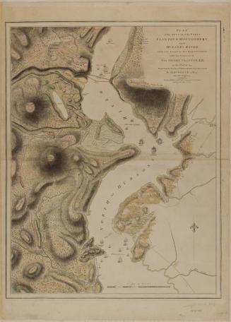
PLAN/ of the ATTACK of the FORTS/ CLINTON & MONTGOMERY,/ upon/ HUDSONS RIVER/ which were Stormed by HIS MAJESTYS FORCES/ under the Command of/ SIR HENRY CLINTON, K. B./ on the 6.th of Oct.r 1777.
1784
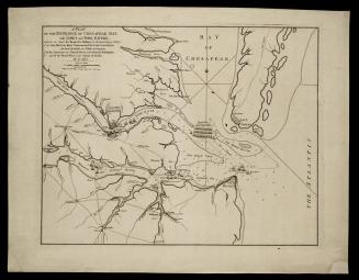
A PLAN/ OF THE ENTRANCE OF CHESAPEAK BAY,/ with JAMES and YORK RIVERS;
November 26, 1781
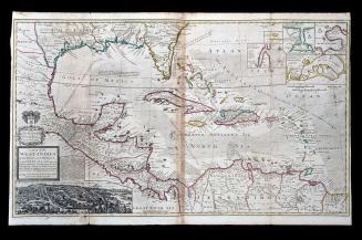
A MAP of the/ WEST-INDIES/ or the Islands of AMERICA/ in the NORTH SEA; with y.e adjacent/ Countries; explaining what belongs to SPAIN,/ ENGLAND, FRANCE, HOLLAND &c.
1740-1745 (originally published 1715)
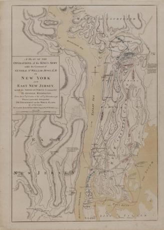
A PLAN OF THE/ OPERATIONS of the KING'S ARMY/ under the Command of/ GENERAL S.R WILLIAM HOWE, K. B./ IN/ NEW YORK/ AND/ EAST NEW JERSEY,/ against the AMERICAN FORCES Commanded/ By GENERAL WASHINGTON,
1777
THE/ AMERICAN/ Military Pocket Atlas;/ BEING/ An approved Collection of Correct MAPS,/ BOTH GENERAL AND PARTICULAR,/ OF/ THE BRITISH COLONIES;/ Especially those which now are, or probably may be/ THE THEATRE OF WAR:
1776
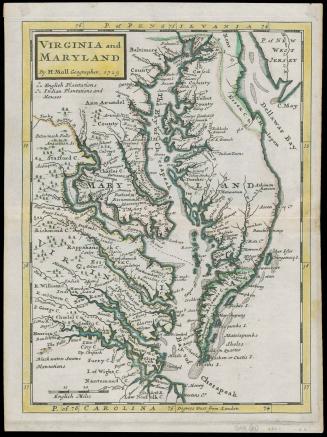
VIRGINIA and/ MARYLAND
1729 (originally published 1708)
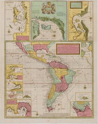
A New & Exact MAP of the Coast, Countries/ and Islands within y.e LIMITS of y.e/ SOUTH SEA COMPANY,/ from y.e River Aranoca to Terra del Fuego, and from thence/ through y.e South Sea to y.e North Part of California &c.
ca. 1740 (originally published 1711)
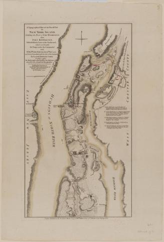
A Topographical MAP of the North.n Part/ OF/ NEW YORK ISLAND,/ Exhibiting the PLAN of FORT WASHINGTON,/ now/ FORT KNYPHAUSEN,/ with the Rebels Lines to the Southward,/ which were Forced by/ the Troops under the Command of/ THE/ R.t Hon.ble EARL PERCY...
1777
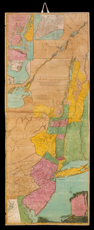
The PROVINCES of/ NEW YORK,/ and NEW JERSEY;/ with part of/ PENSILVANIA,/ and the Province of QUEBEC.
August 17, 1776
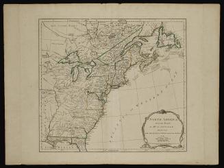
NORTH AMERICA/ from the French/ of M.R D'ANVILLE
June 10, 1775
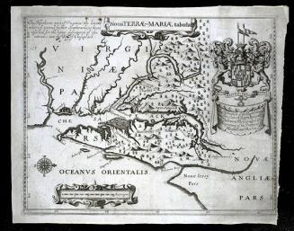
Noua TERRÆ-MARIÆ tabula
1671
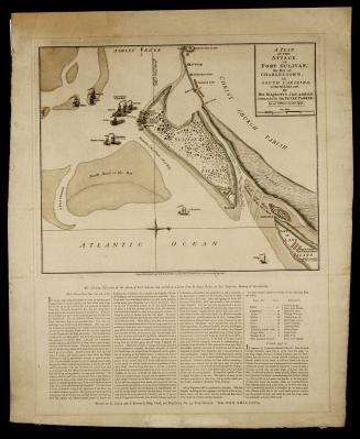
A PLAN/ OF THE/ ATTACK,/ OF/ FORT SULIVAN,/ the Key of CHARLESTOWN,/ in SOUTH CAROLINA,/ on the 28.th of June 1776.
September 7, 1776
Next Page