Skip to main content
Collections
The Collections
Exhibitions
Favorites
Advanced Search
Home
Search Objects
Search
Objects
(12,491)
People
(26,330)
Exhibitions
(56)
Close
Refine Results
Artist / Maker / Culture
*
Robert Morden (d. 1703)
(9)
Richard Blome
(1)
Philip Lea
(1)
Christopher Browne
(1)
John Thornton
(1)
John Thornton
(1)
William Berry
(1)
Phillip Lea (fl. 1666-1700, d. 1700)
(1)
Classification(s)
*
Maps
(9)
Exhibitions
More than Meets the Eye: Maps and Prints of Early America
(1)
Promoting America: Maps of the Colonies and the New Republic
(1)
Date
to
Department
CWF Collection
(9)
Image Available
Origin
England, London
(9)
Sort:
Relevance
Title (A–Z)
Date (Older First)
Object number (Ascending)
Primary Maker (A-Z)
Last Updated (Ascending)
List
Images
Table
Filters
9 results for
*
Result type
Objects
People
Exhibitions
Maps
Robert Morden (d. 1703)
Clear All Filters
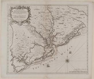
New Map of the Cheif Rivers, Bayes, Creeks,/ Harbours, and Settlements, in/ SOUTH CAROLINA./ Actually Surveyed...
ca. 1695
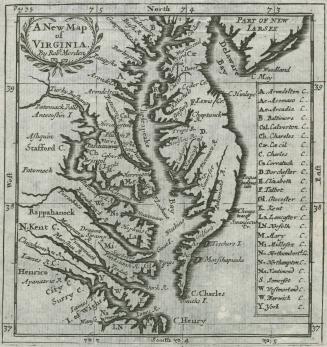
A New Map of Virginia By Robt. Morden
1688/1693/1700
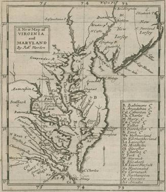
A New Map of Virginia and Maryland By Robt. Morden
1680
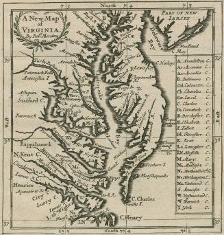
A New Map of VIRGINIA
1688
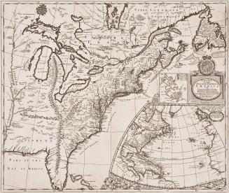
A New Map of the English Empire in America viz Virginia New York Maryland New Jarsey Carolina New England Pennsylvania Newfoundland New France &c by Rob: Morden Sold by Rob't Morden at the Atlas in Cornhill. And by Christopher Brown at ye Globe near the West end of St. Pauls Church: London
1695
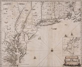
New Map of New England New York New Jarsey Pensilvania Maryland and Virginia
1685
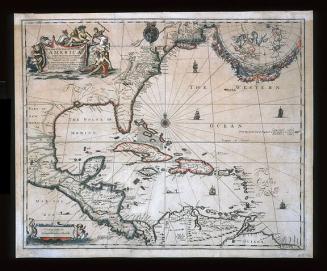
A New Map of the ENGLISH PLANTATIONS in/ AMERICA./ both Continent and Ilands,/ Shewing their true Situation and distance, from/ England or one with another
1673
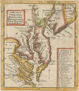
A. New Map of VIRGINIA. MARYLAND. PENSILVANIA. NEW YARSEY
1687
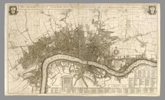
This Actuall Survey of London, Westminster & Southwark is Humbly Dedicated to Ye Ld. Mayor & Court of Alderman
1700
Next Page