Skip to main content
Collections
The Collections
Exhibitions
Favorites
Advanced Search
Home
Search Objects
Search
Objects
(12,491)
People
(26,330)
Exhibitions
(56)
Close
Refine Results
Artist / Maker / Culture
*
James Turner (1722-1759)
(7)
Lewis Evans (ca. 1700-1756)
(6)
Robert Dodsley
(2)
John D. Davis
(1)
Nicholas Scull (1687-1762)
(1)
James Alexander
(1)
Classification(s)
*
Maps
(7)
Date
to
Department
CWF Collection
(7)
Image Available
Origin
America, Massachusetts, Boston
(3)
America, Pennsylvania, Philadelphia
(3)
England, London
(1)
Sort:
Relevance
Title (A–Z)
Date (Older First)
Object number (Ascending)
Primary Maker (A-Z)
Last Updated (Ascending)
List
Images
Table
Filters
7 results for
*
Result type
Objects
People
Exhibitions
Maps
James Turner (1722-1759)
Clear All Filters
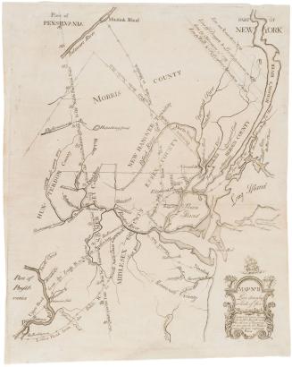
Map No. III (Map of New Jersey)
1747
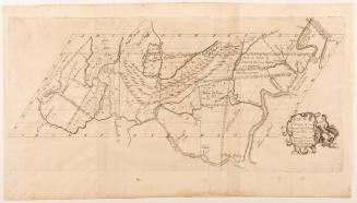
To the Honourable/ Thomas Penn and Richard Penn Esq.rs/ True & absolute Proprietaries & Governours of the Province of/ Pennsylvania & Counties of New-Castle Kent & Sussex on Delaware/ THIS MAP/ Of the improved Part of the Province of/ PENNSYLVANIA.
1759
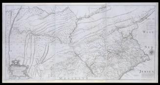
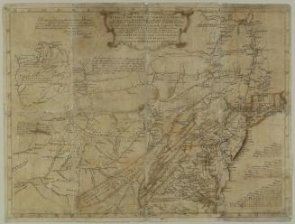
New York, Pennsylvania, Maryland, Virginia, and Carolina (no title)
1747
A general MAP of the/ MIDDLE BRITISH COLONIES, in AMERICA;/ Viz VIRGINIA, MÀRILAND, DÈLAWARE, PENSILVANIA,/ NEW-JERSEY, NEW-YORK, CONNECTICUT, and RHODE ISLAND...
1755
A general Map of the/ MIDDLE BRITISH COLONIES, in AMERICA,/. Viz VIRGINIA, MARILAND, DELAWARE, PENSILVANIA,/ NEW JERSEY, NEW YORK, CONNECTICUT, and RHODE ISLAND:
1755
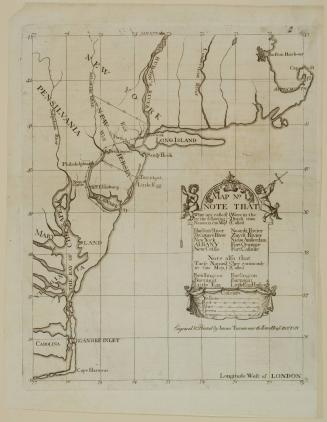
Map No. II (Map of New York and New Jersey)
1747
A General Map of the Middle British Colonies
1755
Next Page