The History of the Origin, Progress and Termination of the American War
Date1794
Maker
Charles Stedman
(1753 - 1812)
OriginEngland, London
MediumTwo volumes; Modern marble paper and leather binding with leather corners and spine with gold gilt lettering and letterpress on laid paper.
DimensionsA: OH: 11" x OW: 8 5/8" x OD: 1 7/8"
B: OH: 11" x OW: 8 5/8" x OD: 1 7/8"
Credit LineMuseum Purchase
Object number2017-146,1&2
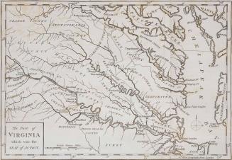
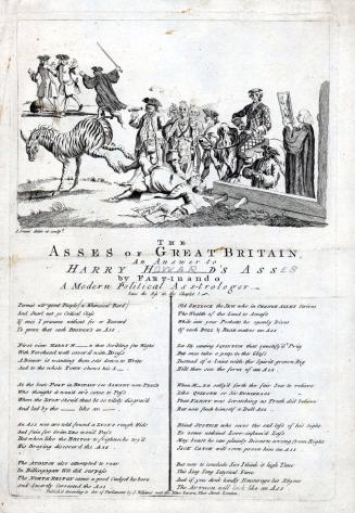
DescriptionThe title page of Volume I: "THE/ HISTORY/ OF THE/ ORIGIN, PROGRESS, AND TERMINATION/ OF THE/ AMERICAN WAR./ By C.STEDMAN,/ WHO SERVED UNDER SIR W. HOWE, SIR H. CLINTON, AND/ THE MARQUIS CORNWALLIS./ IN TWO VOLUMES./ VOL. I./ LONDON:/ PRINTED FOR THE AUTHOR;/ AND SOLD BY J. MURRAY, FLEET-STREET; J. DEBRETT, PICADILLY; AND/ J. KERBY, CORNER OF WIGMORE-STREET, CAVENDISH-SQUARE./1794."Label TextIn 1794, Philadelphia loyalist Charles Stedman published this book, which is "generally considered the best contemporary account of the Revolution written from the British side." (Sabin) During the Revolution, Stedman served as an officer under General William Howe in the British army, and thus had firsthand knowledge of many of the people and events he writes about. The book contains accurate descriptions of the events in all major theatres of the war. His account is accompanied by 15 maps, which are considered some of the best maps depicting the campaigns of the Revolution.
Contains the following:
Vol 1:
"A PLAN/ OF THE/ ACTION AT BUNKERS HILL,/ on the 17th of June 1775./ Between HIS MAJESTY'S TROOPS,/ Under the Command of MAJOR GENERAL HOWE,/ AND THE AMERICAN FORCES:/ Engraved for STEDMAN'S HISTORY of the American War."
"Sketch of/ GENERAL GRANTS POSITION/ on/ LONG ISLAND./ Engraved for Stedman's History of the American War."
"A Topographical MAP of the Northn. Part/ OF/ NEW YORK ISLAND,/ Exhibiting the PLAN of FORT WASHINGTON,/ now/ FORT KNYPHAUSEN,/ shewing the several Attacks/ of the/ ROYAL ARMY."
"A PLAN OF THE/ OPERATIONS of the KING'S ARMY/ under the Command of/ GENERAL SR. WILLIAM HOWE, K.B./ IN/ NEW YORK/ AND/ EAST NEW JERSEY,/ against the AMERICAN FORCES Commanded/ By GENERAL WASHINGTON,/ From the 12th of October, to the 28th of November 1776./ Wherein is particularly distinguished/ THE ENGAGEMENT on the WHITE PLAINS, the 28th of October."
"PLAN OF THE POSITION which the ARMY under LT. GENL. BURGOINE took at SARATOGA/ on the 10th of September 1777, and in which it remained till the CONVENTION was signed."
"PLAN/ of the ATTACK of the FORTS/ CLINTON & MONTGOMERY,/ upon/ HUDSONS RIVER/ which were stormed by HIS MAJESTYS FORCES/ under the Command of/ SIR HENRY CLINTON, K.B./ on the 6th of Octr. 1777."
"Sketch of/ FAYETTE'S/ POSITION at BARREN HILL."
Vol 2:
"PLAN/ of the SIEGE of SAVANNAH,/ with the joint Attack of the French and Americans/ on the9th October 1779/ In which they were defeated by his MAJESTY'S Forces/ under the Command of Major Genl. Augustin Prevost,/ From a Survey by an Officer."
"PLAN/ of the SIEGE of/ CHARLESTOWN/ in/ SOUTH CAROLINA."
"PLAN/ OF THE BATTLE/ Fought near CAMDEN/ August 16th./ 1780."
"SKETCH of the CATAWBA RIVER at McCOWANS FORD."
"BATTLE OF GUILDFORD,/ Fought on the 15th of March 1781."
"SKETCH/ of the/ BATTLE/ OF/ HOBKIRKS HILL,/ near/ CAMDEN./ on the 25th April, 1781./ Drawn by C. Vallancey, Captn. of the Vols. of Ireland."
"POSITION/ of the/ ENGLISH and FRENCH FLEETS/ Immediately previous to the/ ACTION./ on the 5th of Sepr. 1781."
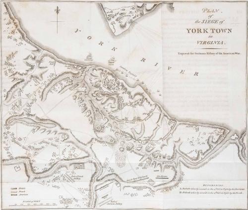
"PLAN/ of/ the SIEGE of/ YORKTOWN/ in/ VIRGINIA."*
*This copy published in William C. Wooldridge, "Mapping Virginia: From the Age of Exploration to the Civil War" (Charlottesville: University of Virginia Press, 2012), pp. 179-181, #163.
September 1, 1798

August 1, 1778


1787


1760-1770

1824-1828 (range of the entires in the album).

1741