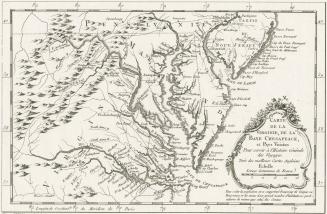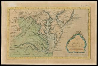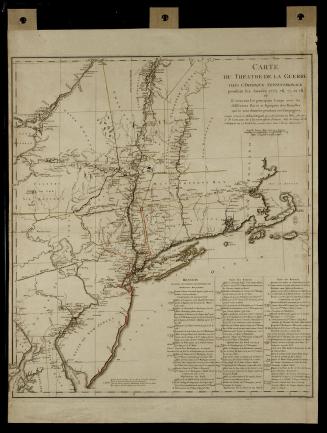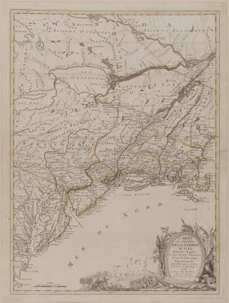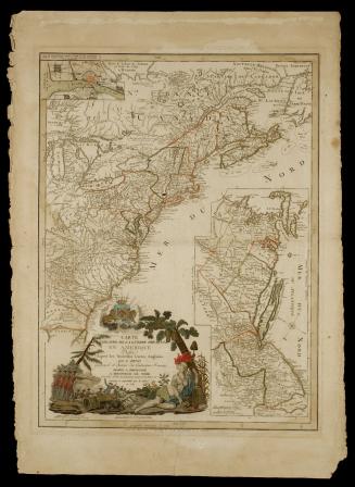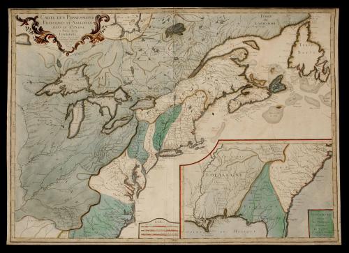
CARTES DES POSSESSIONS/ FRANCOISES ET ANGLOISES/ DANS LE CANADA,/ et Partie de la/ LOUISIANE.
Date1756
Maker
S.G. Longchamps
Engraver
L. Thevenard
Engraver
Chambon
Publisher
Louis Charles Desnos
(1725 - 1805)
OriginEurope, France, Paris
MediumBlack and white line engraving with period hand color on laid paper
DimensionsOH: 21 3/4" x OW: 30 1/2" (trimmed to plate mark)
Credit LineGift of Mr. John D. Rockefeller, Jr.
Object number1937-291
Label TextThis map depicts the French and English land possessions from Canada to the Carolinas and from the Atlantic Coast to the Mississippi River. A supplement is inset in the bottom right corner depicting Louisianna, northern Florida, and most of the Carolinas. Published in Louis Charles Desnos' "Atlas General."The cartouche in the upper left corner reads: "CARTE DES POSSESSIONS/ FRANCOISES ET ANGLOISES/ DANS LE CANADA,/ et Partie de la/ LOUISIANE./ A Paris. Ches le Sieur/ Longchamps, Geographe,/ rue Saint Jacques, a/ l'Enseigne de la/ Place des/ Victoires./ C.P.R./ 1756./ L. Thevenard fil. sculp."
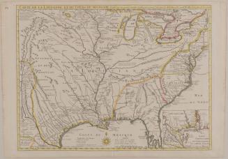
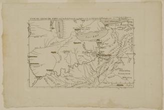
The inset cartouche reads: "SUPLEMENT/ POUR/ les Possessions/ Francoises/ et Angloises/ la Sud de la Louisiane./ Grave par Chambon."
The scale reads: "Echelles./ Mille Pas geometriques de 60 au Degre./ Lieues communes de France de 25 au Degre./ Lieues maries de France et d'Angleterre de 20 au Degre."
ProvenanceGiven to Mr. John D. Rockefeller, Jr. by Senator Honnorat.