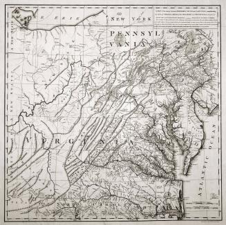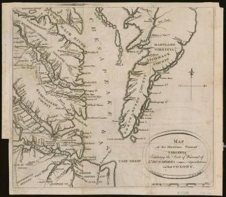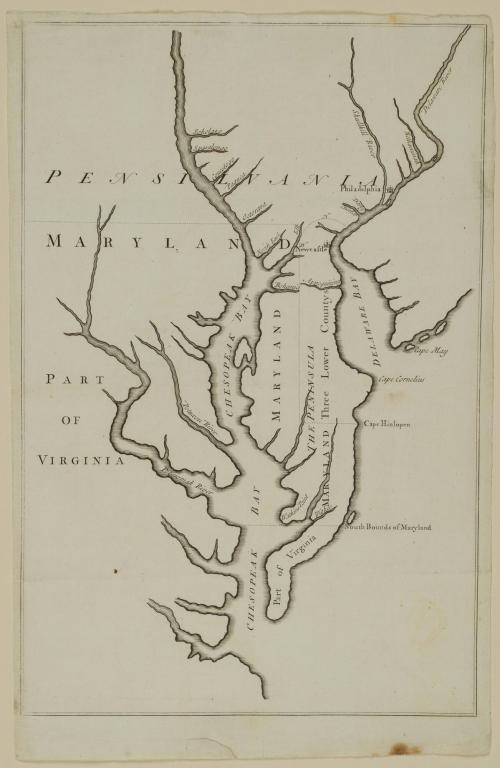
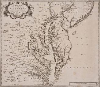
Map of Pennsylvania, Maryland, and part of Virginia (no title)
Date1732
Engraver
Thomas Hutchinson
(1711 - 1780)
Publisher
John Senex (1678-1740)
OriginEngland, London
MediumLine engraving on laid paper
DimensionsOverall: 14 1/4 × 9 7/16in. (36.2 × 24cm)
Framed: 23 × 17 1/16 × 7/8in.
Credit LineGift of Mrs. Anna Glen B. Vietor in memory of her husband, Alexander O. Vietor
Object number1984-43
Label TextOne of the disputes over the limits of Lord Baltimore's grant, involving the eastern and nothern boundaries of Maryland, occurred when William Penn was granted a charter for Pennsylvania in 1680. Penn and his lawyers disputed the Dutch settlements on the east side of the Delmarva peninsula. They also questioned whether the northern boundary should be at the fortieth degree of latitude as accurately surveyed or at the latitude where it was thought to have been in 1632 when Lord Baltimore's charter was granted.In 1732, the Penns and Lord Baltimore each submitted a manuscript map, one of which was to be selected and mutually agreed upon as a basis for negotiation. Unfortunately for Lord Baltimore, it was his incorrect map that was chosen and printed for the negotiations. This map, based on one by Nicholas Visscher, placed Cape Henlopen much father south than it actually is. In 1685, the king had decreed that the southern boundary of the Penns' grant was to extend from Cape Henlopen to the center of the peninsula. Thus it was Lord Baltimore's own erroneous map that cost him thousands of acres.
This copy of the map used during the negotiations is one of the few issued in the first printing. It is signed on the reverse by the Penns' attorney, John Fernando Paris.
InscribedText on the reverse reads: "Penn/ &/ Lord Balt/ The Map which/ is referr'd to./ Paris."

1723-1728, originally published ca. 1701