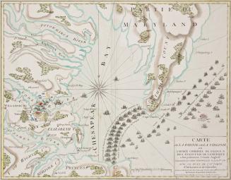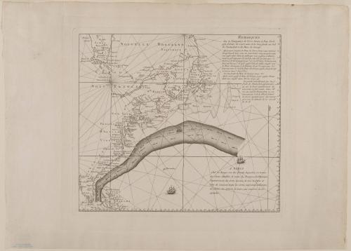
"Map of the Gulf Stream" (no title)
Date1780-1783
Cartographer
George Louis Le Rouge (fl. 1740-1780)
After work by
Timothy Folger
OriginEurope, France, Paris
MediumLine engraving on laid paper
DimensionsOverall: 17 3/8 × 24 1/2in. (44.1 × 62.2cm)
Framed: 27 1/4 × 28 1/4 × 1 1/16in.
Credit LineGift of Mrs. Anna Glen B. Vietor in memory of her husband, Alexander O. Vietor
Object number1985-1
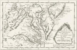
DescriptionThe text in the upper right corner reads: "REMARQUES/ Sur la Navigation de Terre-Neuve à New-York/ afin d'éviter les Courrants et les bas-fonds au Sud/ de Nantuckett et du Banc de George." The flow of the Gulf Stream is clearly delineated in the lower half of the map.
The text in the lower right corner reads: "A PARIS/ Chés Le Rouge rue des Grands Augustins, on trouve/ des Cartes détaillées de toutes les Provinces de l'Amérique/ Septentrionale, des Cartes marines de tous les Ports et/ Côtes du Continent, touttes les Cartes imprimées en Europe,/ des Globes, des Spheres et tout ce qui concerne la Gé-/ ographie."
Label TextOne of the preferred routes that captains and navigators sailing from America to England learned to use was the Gulf Stream, a strong, warm current that flows north along the Atlantic coast and then east toward Europe.
Benjamin Franklin, deputy postmaster general for the American colonies, received a complaint in 1768 from a Boston customs official that mail packets sailing from Falmouth, England, to New York routinely took longer than merchant ships from London to Rhode Island. This was especially puzzling since packet ships were faster than merchant vessels. Franklin consulted his cousin, Timothy Folger, a navigator from Nantucket, who explained that the slower voyage to New York was due to the Gulf Stream, a current well known to Nantucket whalers. Franklin requested that Folger draft a chart showing the course and dimensions of the Gulf Stream and provide instructions so that captains bound for Newfoundland and New York could avoid it.
In Paris as minister to the French court between 1780 and 1783, Franklin commissioned mapmaker George Louis Le Rouge to publish this version of the chart. Colonial Williamsburg’s map is one of three known with a history of having belonged to Franklin.
MarkingsTwo watermarks
ProvenanceThis map has a history of belonging to Benjamin Franklin who authorized the printing of this chart. Ex-collection: Mr. Alexander O. Vietor.
ca. 1625