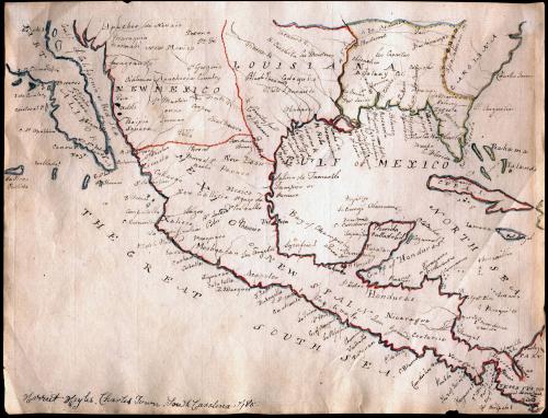
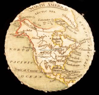
Manuscript Map of Mexico or New Spain
Date1785
Maker
Harriet Hayles
MediumInk and watercolor on laid paper
DimensionsOH: 7in x OW: 9 1/4in
Credit LineMuseum Purchase, The Friends of Colonial Williamsburg Collections Fund
Object number2012-175
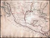
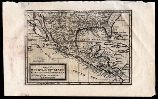
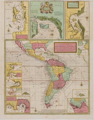
DescriptionManuscript Map of Mexico or New Spain done by a school girl, Harriet Hayles, in Charleston, South Carolina in 1785.Label TextThis hand-drawn (manuscript) map is signed by “Harriet Hayles, Charles Town, South Carolina, 1785.” Hayles’ map depicts southern half of North America and Mexico. It was copied from a printed map by Herman Moll that was originally published in the early 18th century (see 2013-2).
Little is known about Hayle’s life other than that she was an early recipient of geographic education for American women. The study of geography for girls began in England in the 1770s and was introduced to America around the time of the Revolution, taking off in the 1790s. Most mapmaking in schools was meant to reinforce learning about history and other academic pursuits – such as drawing, music, dance, and some embroidery.
Students who mastered geography in this way could demonstrate their knowledge by completing an embroidered map sampler or hand-drawn atlas – which Hayles appears to have been compiling. This manuscript map likely came out of a bound book (page number 193), suggesting that she made quite a few of these maps – perhaps creating her own atlas for reference or future use. It’s important to note that the exercise was not designed to teach women how to survey or to make maps. Rather, women were creating these examples and demonstrating skills that they could use to educate their own children or to find employment in schools.

1800-1820


1723-1728, originally published ca. 1701

After 1735; originally published 1715