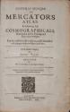
Historia Mundi: or Mercator's Atlas
Date1636
Maker
Gerard Mercator
(1512 - 1594)
OriginEngland, London
MediumMarble boards with leather spine and corners.
DimensionsOH: 12 1/4" x OW: 8 1/4" x OD: 3"
Credit LineMuseum Purchase
Object number2017-50
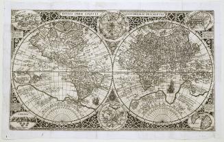
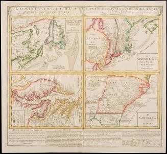
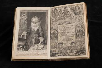
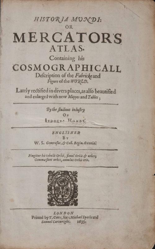
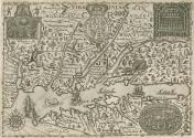
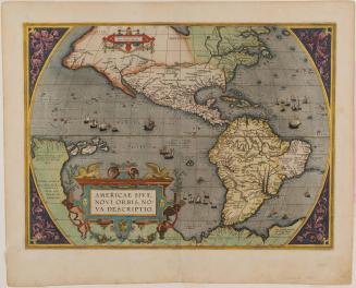
DescriptionTitle page reads: "HISTORIA MUNDI:/ OR/ MERCATOR'S/ ATLAS./ Containing his/ COSMOGRAPHICALL/ Description of the Fabricke and./ Figure of the WORLD./ Lately rectified in divers places, as also beautified/ and enlarged with new Mappes and Tables;/ By the studious industry/ OF/ IVDOCVS HONDY./ ENGLISHED/ BY/ W.S Genrous, & Coll. Regin. Oxoniae./ Pingitur his tabulis Orbis, simul Orbis & urbes;/ Gemmae sunt urbes, annulus Orbis erit../ LONDON/ Printed by T. Cotes, for Michael Sparke and/ Samuel Cartwright. 1635."Label TextThe original reduced-size Mercator atlas (or "Minor Mercator") was originally published in Amsterdam in 1608. This English "Minor Mercator" came twenty-seven years later when Michael Sparke purchased the plates from the old Dutch atlas and Wye Saltonstall "Englished" or translated the tome into English. Rather than using the outdated and generalized Dutch map of the east-coast of North America wherein Virginia was broadly defined, he commissioned Ralph Hall to create a new map.
The result was a quirky map with armed soldiers and Native Americans, prowling leopards, herds of pigs, and a sea monster. The geography and decorative vignettes are derived from the 1612 John Smith map of Virginia - making it Derivative 6. The title is on a banner with both ends split along the top center of the plate. There is a large coat of arms surmounted by a crown which interrupts the title. There are three illustrations from De Bry. In the upper left corner is a scene of Indians sitting around a fire before a chief. In the upper right corner is a view of the interior of an Indian hut showing bodies lying side by side. In the bottom right hand corner is a birds-eye view of a stockade village.Note the inscription "Hall poynt” at the center of the map. This fictitious place name was added by the maker: Ralph Hall
The map was not ready at the time the book was available for sale, but Starke offered to provide a copy of the Virginia map for his customers who purchased the atlas to paste into the book later, though it appears many did not. It also appeared in the 1637 and 1639 editions of "Historia Mundi" pasted in over another map. In addition to the Hall, two other maps were updated including Munster p. 554 and Ceylon p. 887. In total there were approximately 184 maps included in the book.
This copy is published in William C. Wooldridge, Mapping Virginia: From the Age of Exploration to the Civil War (Charlottesville: University of Virginia Press, 2012), #39a, b, c,pp. 44-47.
May 1587
1592 (originally published 1587)