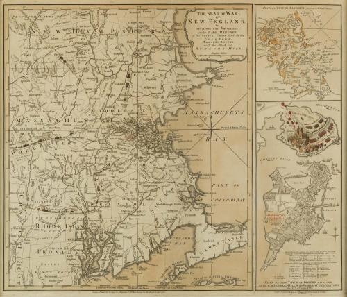


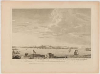
Seat of War in New England by an American Volunteer
Date1775
Publisher
Robert Sayer (1725-1794) & John Bennett (fl. 1760-1787)
OriginEngland, London
MediumLine engraving on laid paper
DimensionsFramed: 24 5/8 × 27 5/16in.
Other (Window): 17 1/4 × 20 5/8in. (43.8 × 52.4cm)
Credit LineBequest of Mr. and Mrs. Joseph H. Hennage
Object number2020-350
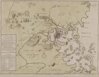
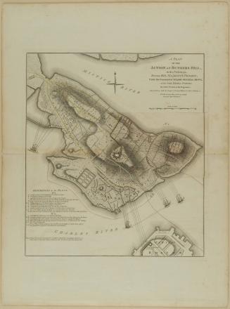
DescriptionThe lower right inset reads: “Plan of the TOWN of BOSTON with the/ Attack on BUNKERS-HILL in the Peninsula of CHARLESTOWN,/ the 17th of June 1775. The lower margin reads: “Longitude West from Boston. Meridian from Boston. Longitude East from Boston.”
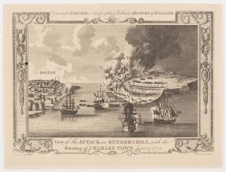
Label TextThe Battle of Bunker Hill was one of the first battles of the Revolutionary War, occurring before the signing of the Declaration of Independence. The battle’s importance in the minds of English and Americans both is shown by the speed at which this map was produced: the battle took place on June 17, 1775; the map was printed three months later on September 2 of that same year. The map shows American and English troop movements, including a detailed depiction of the Battle of Bunker Hill.


December 1774