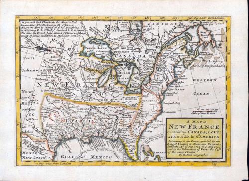
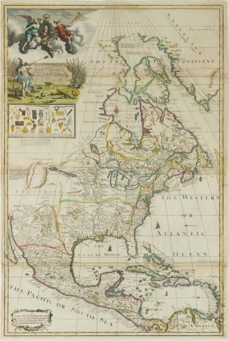
A MAP of/ NEW FRANCE/ Containing CANADA, LOUI=/SIANA &c. in N.th AMERICA.
Date1712-1730
Cartographer
Herman Moll (1654?-1732)
Engraver
Herman Moll (1654?-1732)
Publisher
Herman Moll (1654?-1732)
OriginEngland, London
MediumBlack and white line engraving with period hand color on laid paper
DimensionsOH: 8 3/4" x OW: 11 7/8"; Plate H: 7 3/8" x W: 10 3/8"
Credit LineMuseum Purchase
Object number1957-86
DescriptionThis map depicts the eastern coast of North America, from Newfoundland to Florida, and westward to San Antonio.The title cartouche at the bottom right reads: "A MAP of NEW FRANCE/ Containing CANADA, LOUI=/SIANA &c. in N.th AMERICA./ According to the Patent granted by the/ King of France to Monsieur Crozat,/ dated the 14.th of Sep. 1712. N.S. and regis:/tred in the Parliament of Paris the 24th/ of the same Month./ By H. Moll Geographer."
The upper left corner reads: "NB You will find Florida in this Map called/ Louisania; the R. Misisipi R. St. Louis;/ Massacre Port & Haven of y.e Isl. Dauphine;/ le Missiours R. R. S.t Philip; Ouabach R. R. S.t Jerom./ For thus the French have altered y.e Names in y.e King's/ Grant of those Countries to Monsieur Crozat."


After 1735; originally published 1715
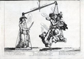
January 17, 1781

February 16, 1782

