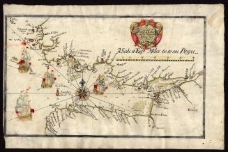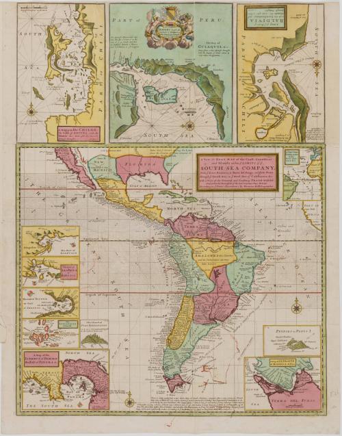
A New & Exact MAP of the Coast, Countries/ and Islands within y.e LIMITS of y.e/ SOUTH SEA COMPANY,/ from y.e River Aranoca to Terra del Fuego, and from thence/ through y.e South Sea to y.e North Part of California &c.
Dateca. 1740 (originally published 1711)
Cartographer
Herman Moll (1654?-1732)
Engraver
Herman Moll (1654?-1732)
OriginEngland, London
MediumLine engraving on laid paper with hand color
DimensionsOverall (Includes false margin): 26 5/8 × 22 1/4in. (67.6 × 56.5cm)
Other (Plate): 25 5/8 × 19 1/2in. (65.1 × 49.5cm)
Credit LineMuseum Purchase
Object number1985-165
DescriptionThe center cartouche reads: "A New & Exact MAP of the Coast, Countries/ and Islands within y.e LIMITS of y.e/ SOUTH SEA COMPANY,/ from y.e River Aranoca to Terra del Fuego, and from thence/ through y.e South Sea to y.e North Part of California &c./ with a View of the General and Coasting TRADE-WINDS./ And particular Draughts of the most important Bays, Ports &c./ According to y.e Newest Observations, By Herman Moll Geographer."


After 1735; originally published 1715