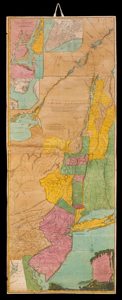
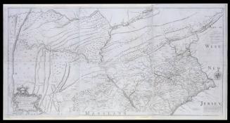
The PROVINCES of/ NEW YORK,/ and NEW JERSEY;/ with part of/ PENSILVANIA,/ and the Province of QUEBEC.
DateAugust 17, 1776
Cartographer
Major Samuel Holland (1728-1801)
Cartographer
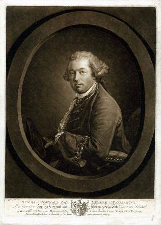
Governor Thomas Pownall (bapt. 1722-1805)
Publisher
Robert Sayer (1725-1794) & John Bennett (fl. 1760-1787)
OriginEngland, London
MediumLine engraving on laid paper with hand color
DimensionsOverall: 53 × 21 1/4in. (134.6 × 54cm)
Credit LineMuseum Purchase
Object number1988-23
DescriptionThe cartouche reads: "The PROVINCES of/ NEW YORK/ and/ NEW JERSEY;/ with part of PENSILVANIA,/ and the Province of QUEBEC./ Drawn by MAJOR HOLLAND,/ SURVEYOR GENERAL,/ of the NORTHERN DISTRICT in AMERICA./ Corrected and Improved,/ from the Original Materials,/ by GOVERN: POWNALL,/ MEMBER of PARLIAMENT,/ 1776."The lower margin reads: "London. Printed for Rob.t Sayer & John Bennett, N.o 53, in Fleet Street, as the Act directs, 17 Aug.t 1776."
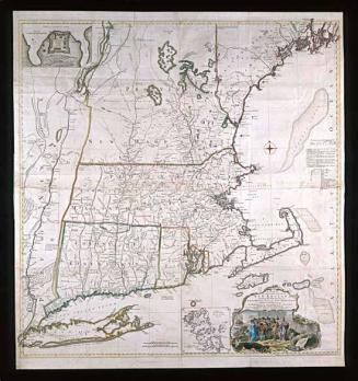
Label TextSamuel Johannes Holland compiled the first map of New York published after the French and Indian War. Holland was a Dutch military engineer who became the Surveyor General for the Northern District in 1764. His work, first published in 1768, was based on maps and military surveys from the 1750s. The map was revised several times, resulting in this 1776 edition by Thomas Pownall, a Member of Parliament and former colonial administrator in New York and Massachusetts. The map’s vertical presentation and cartouche, which features an idyllic Hudson River scene, emphasizes the importance of the Hudson River-Lake Champlain corridor for fur trade with the Iroquois.
InscribedOn the reverse: "New York & New Jersey w.th part of Pensilvania & Quebec/ N 154.10"


June 10, 1775