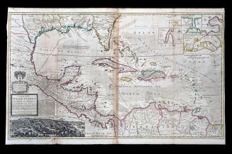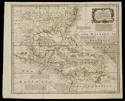
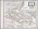
A/ NEW and ACCURATE CHART/ of the/ WEST INDIES,/ with the Adjacent Coasts of NORTH/ and SOUTH AMERICA.
Date1748
Cartographer
Emanuel Bowen
(ca. 1694 - 1767)
OriginEngland, London
MediumBlack and white line engraving on laid paper
DimensionsOH: 15 7/8" x OW: 19 5/8"; Plate H: 14 7/8" x W: 18"
Credit LineMuseum Purchase
Object number1989-321
DescriptionThe upper right cartouche reads: "A/ NEW and ACCURATE CHART/ of the/ WEST INDIES,/ with the Adjacent Coasts of NORTH/ and SOUTH AMERICA./ Drawn from the best Authorities, assisted/ by the most approved modern Maps & Charts,/ and Regulated by Astronom.l Observations./ By Eman. Bown Geographer to His Majesty."