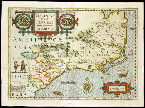

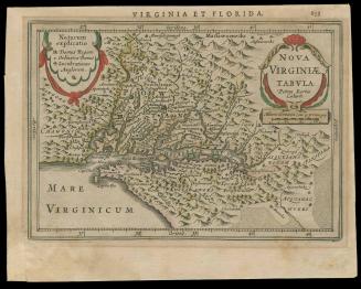
VIRGINIAE/ Item et/ FLORIDAE/ Americae Provinciarum, nova/ DESCRIPTIO.
DateFirst published 1606; This example: 1634
Cartographer
Jodocus Hondius I
(1563 - 1612)
Cartographer
Gerard Mercator
(1512 - 1594)
After work by
John White
(fl. 1585 - 1593)
After work by
Jacques Le Moyne de Morgues (d. 1587)
MediumBlack and white line engraving with period hand color on laid paper
DimensionsOH: 15 1/4" x OW: 20 7/8"; Plate H: 13 5/8" x W: 19 1/8"
Credit LineMuseum Purchase
Object number1996-813
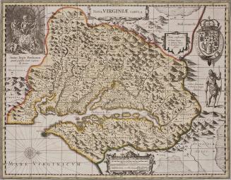
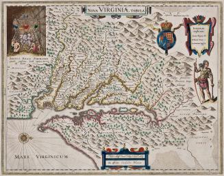
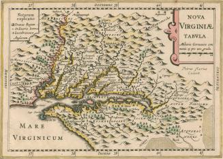
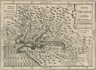
DescriptionThe cartouche in the lower right corner reads: "Medius Meridianus est 300, reli:/ qui ad hunc inclinantur pro ratione/ 30. & 37, parallelorum." (That the middle meridian of the region is 300 degress, and the latitude extends from 30 degrees to 37 degrees.)The cartouche in the upper left corner reads: "VIRGINIAE/ Item et/ FLORIDAE/ Americae Privinciarum, nova/ DESCRIPTIO."
Two ovals on either side of the upper cartouche contain pictures of early settlements and read: "Civitatum Floride imitatio." and "Civitatum Virginiae forma_"
Label TextThis map is by Jodocus Hondius, and is based on maps by White and LeMoyne. The coast of Virginia to mid-Florida and west to the mountains are depicted. Geographical misconceptions of the region continued for many years due to directional changes in the flow of rivers and the location of lakes. A complete description can be found in William Cumming's "The Southeast in Early Maps."
This example has been dated to 1634 based on Burden's "The Mapping of North America."
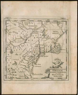
c. 1700
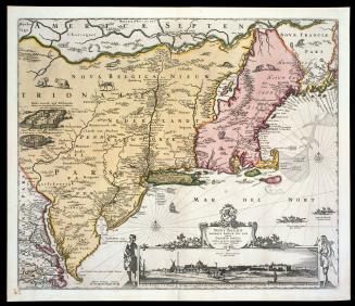
ca. 1684; originally published ca. 1655
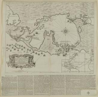
ca. 1760
1824-1828 (range of the entires in the album).