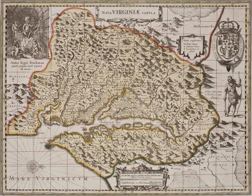
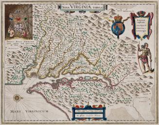
Nova Virginiae Tabula
Datec. 1700
Maker
Henricus Hondius
(1597 - 1651)
Maker
Gerard Valk (ca. 1650-1726)
Maker
Pieter Schenk (1645-1715)
MediumBlack and white line engraving with period color
DimensionsOH: 19 15/16" x OW: 23 15/16"
Credit LineMuseum Purchase
Object number2017-48
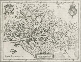
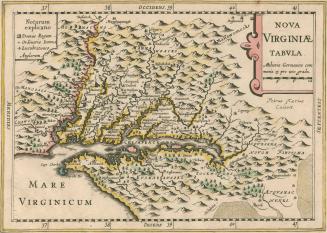
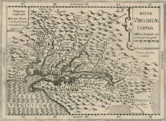
DescriptionThe upper cartouche reads: "NOVA VIRGINIAE TABULA"As in the case of the Smith map, this version carries in the upper left the scene in Powhatan's lodge, labeled as follows: "Staus Regis Powhatan/ quando praefectus Smith Captivus/ illi daretur"
In the upper right is a plaque bearing the inscription: "Notarum/ explicatio./ Domus regum/ Ordinariae Domus/ Lucubrationes An/ glorum"
The lower cartouche reads: "Amstelodami. ex officina apud {PET. SHENK. et/ GER.VALK. C. Priv"
Label TextIn 1694, Gerard Valk and his brother-in-law Pieter Schenk acquired and reworked the Henricus Hondius copperplate of this derivative of John Smith's 1612 map of Virginia. Valk and Schenck made several changes to the plate including the addition of longtiude and latitude lines. Most notably they removed the name of Henricus Hondius and adding their own names. This map is recognized by Coolie Verner as derivative 5, state 2.
This copy is published in William C. Wooldridge, "Mapping Virginia: From the Age of Exploration to the Civil War" (Charlottesville: University of Virginia Press, 2012), pp. 43-44, #38.
1639-1642
1648
1627
1713