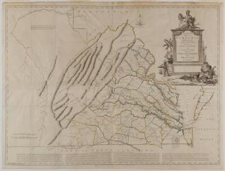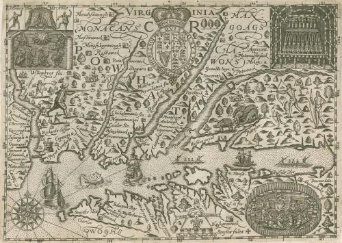
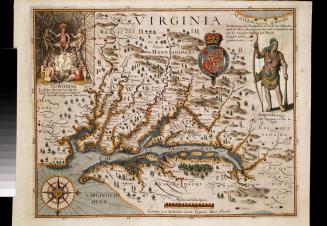
VIRGINIA
Date1636
Compiler
Ralph Hall (fl. 1637)
After work by
Captain John Smith (1580-1631)
OriginEngland, London
MediumBlack and white line engraving on laid paper
DimensionsOH: 7 5/8" x OW: 11 5/8"
Credit LineMuseum Purchase
Object number2017-49
DescriptionThe upper center banner reads: "VIRG/ INIA."Label TextThis is a derivative of Captain John Smith's map of Virginia - Derivative 6. It was meant to appear in Wye Saltonstall's 1636 "Historia Mundi" or Mercator's Atlas, but was not ready in time and printed separately. It also appeared in the 1637 and 1639 editions of "Historia Mundi" pasted in over another map. Note the inscription "Hall poynt” at the center of the map. This fictitious place name was added by the maker: Ralph Hall.
The geographical information is the same as that on the John Smith map. The title is on a banner with both ends split along the top center of the plate. There is a large coat of arms surmounted by a crown which interrupts the title. There are three illustrations from De Bry. In the upper left corner is a scene of Indians sitting around a fire before a chief. In the upper right corner is a view of the interior of an Indian hut showing bodies lying side by side. In the bottom right hand corner is a birds-eye view of a stockade village.
This copy is published in William C. Wooldridge, Mapping Virginia: From the Age of Exploration to the Civil War (Charlottesville: University of Virginia Press, 2012), , pp. 44-45, #39a.
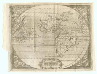
May 1587
1627


1723-1728, originally published ca. 1701